Aug 13: after a poor nights sleep (again) we headed out for another day of slack packing. This time, we would be climbing up and over Mt Kinsman, a 17 mile journey that would essentially bring us from Lincoln back to Lincoln.
Took a little while to get a hitch back to the trailhead. When we got dropped off, we saw the Professor disappearing into the woods.
Mt Kinsman was reported to be almost as steep as Mt Moosilauke with a difference- Kinsman was steep going up and coming down and had 2 summits, the north summit and the south summit.
Shortly after starting our hike, it began to rain. We stopped and put on our pack covers. The terrain was steep, rocky, and root ridden. Progress was slow. At 11:30, right when we predicted we would reach the shelter for lunch, we saw a sign that said the shelter was still 1.1 miles away! This was going to be a long day.
It started raining more heavily about 5 minutes before we reached the shelter. We ducked inside and found the Professor eating his lunch. We hung up our shirts to dry, wrung out our socks, and dug our rain gear out of our packs. We were joined by Forrest Gump and Winterflower, who also had been at Chet's the night before.
After lunch, the really steep climb began. We had several hand over hand climbs up roots and a few rock scrambles- not easy in the rain. Slow progress!
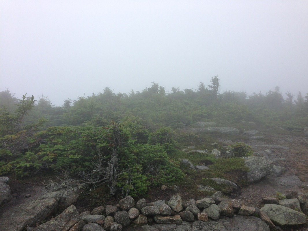
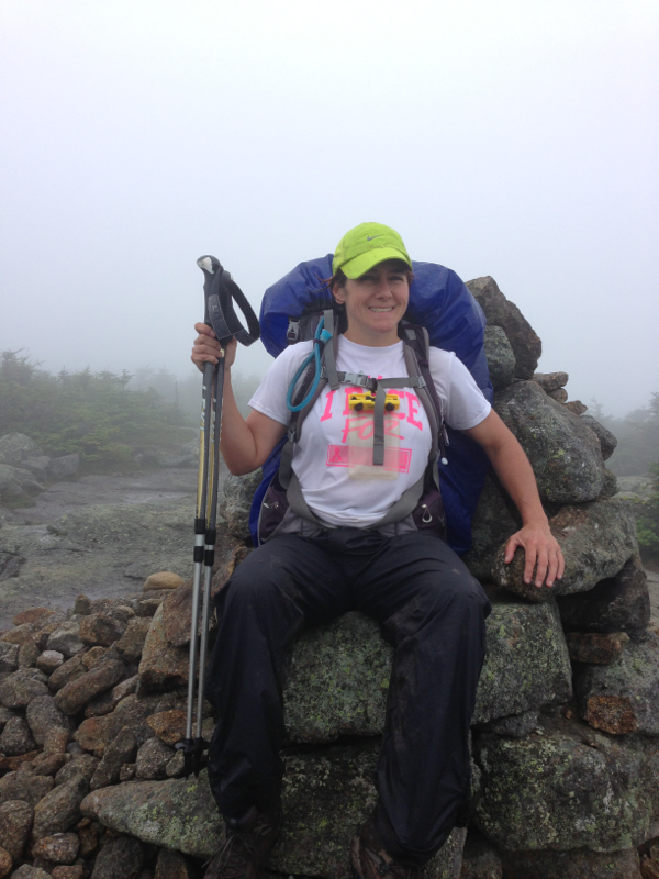
Finally we reached the south summit above tree line. It looked eeiry and otherworldly in the fog. The cairn at the top had been fashioned into a chair, which we, of course, had to sit in.
Took a little while to get a hitch back to the trailhead. When we got dropped off, we saw the Professor disappearing into the woods.
Mt Kinsman was reported to be almost as steep as Mt Moosilauke with a difference- Kinsman was steep going up and coming down and had 2 summits, the north summit and the south summit.
Shortly after starting our hike, it began to rain. We stopped and put on our pack covers. The terrain was steep, rocky, and root ridden. Progress was slow. At 11:30, right when we predicted we would reach the shelter for lunch, we saw a sign that said the shelter was still 1.1 miles away! This was going to be a long day.
It started raining more heavily about 5 minutes before we reached the shelter. We ducked inside and found the Professor eating his lunch. We hung up our shirts to dry, wrung out our socks, and dug our rain gear out of our packs. We were joined by Forrest Gump and Winterflower, who also had been at Chet's the night before.
After lunch, the really steep climb began. We had several hand over hand climbs up roots and a few rock scrambles- not easy in the rain. Slow progress!
Finally we reached the south summit above tree line. It looked eeiry and otherworldly in the fog. The cairn at the top had been fashioned into a chair, which we, of course, had to sit in.
We continued along a relatively flat ridge walk for about 3/4 mile before reaching the climb to north summit- the higher and steeper of the two. More climbing, more rock scrambles, even some rebar thrown in there.
The descent was just as steep.
We stopped at another shelter for a rest and snack about halfway down. Talked to a couple section hikers - father and son- who were out for the weekend. They were doing the 17 miles over 3 days and were exhausted! Me too.
Back on the trail, we encountered a number of wooden ladders down particularly steep sections, as well as the wooden stairs like on Moosilauke. This just didn't let up!
Next, we came upon our first hut. The hits in the White Mpuntains offer dinner, a bunk, breakfast, and a great atmosphere for a big price tag. Thru hikers can often do work for stay- washing dishes or sweeping the floor in exchange for the leftovers from the guests dinner and a spot on the floor of the common room. We would not be staying tonight, but we ducked inside to check it out and use the bathroom.
Things flattened out a little bit after the hut- lots of boardwalking over swampy areas. We came across a sign that said a bridge had washed out and to either be prepared to ford the stream or seek an alternative route. The stream was where things went wrong for us.
At the stream, we walked along the bank until we found a place that was easy yo cross. Then we walked back along the bank on the other side.
When we got to the spot where the bridge had once stood, there were two trails. One was perpendicular to the stream, the other parallel to the stream. The parallel path was marked by white blazes- the sign of the AT. We walked parallel.
If we hadn't been coming off two nights of virtually no sleep, I'm pretty sure we would have caught on quicker. But we were both pretty much brain dead.
Throughout New Hampshire, the trail is impeccably maintained. So as the trail conditions deteriorated, we should have known. But we just kept following the white blazes- the mark of the AT. We followed this trail for about a mile and a half until it just ended. Just like that. One second trail, the next, nothing.
Then we spent over an hour retracing our steps, crossing a second river, bush whacking - anything to figure out where the AT continued. Then the light started fading.
"We need to go back to the bridge" I said. "The other trail looked better. It's got to lead somewhere!"
So back a mile and a half over deteriorated trail to the washed out bridge site. This time we took the perpendicular trail and saw- a white blaze!
The trail had been rerouted and we were on the old trail. (You would think there'd be a sign)
Now on the correct trail, we had another 1.7 miles to the road. In the dark. We had one headlamp for the two of us. And 2 more river crossings. Epic.
Finally we came to the road. The trail had dumped us out on 93 South! We walked down the exit ramp and called for the AMC shuttle.
Finally, after a bit of a wait, we got the shuttle back to Chet's. we had the driver wait a bit while we grabbed our stuff and ran back out to the van. Then we had him drive us to a hotel where we could get some sleep!
 RSS Feed
