heather hikes
  • LIfe on the trail
  • Home
  • About
  • Cool Causes
  • Where I am now
  • Milage

Northern Arizona

4/12/2018

0 Comments

 
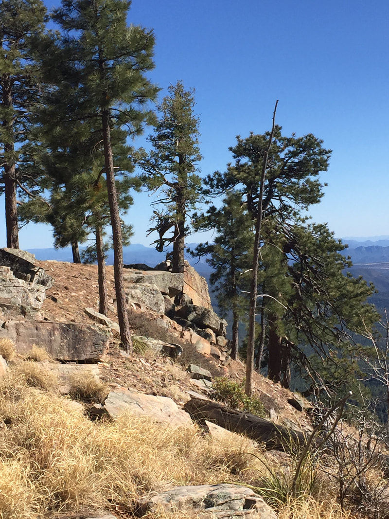
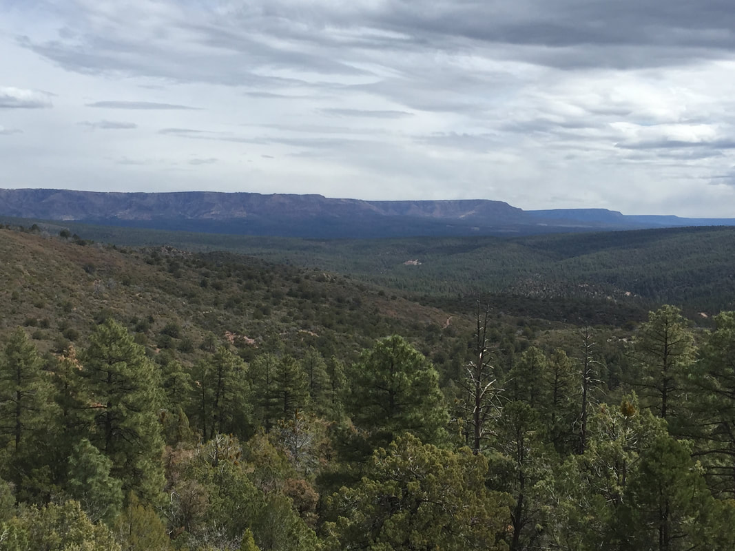
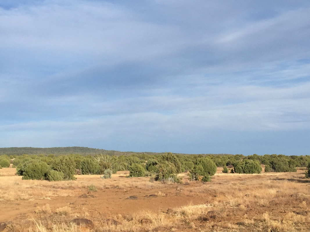
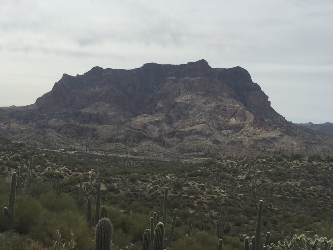
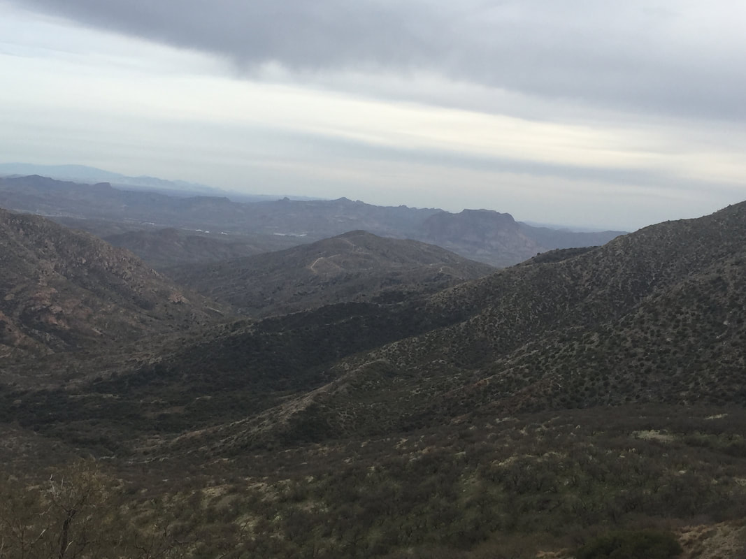
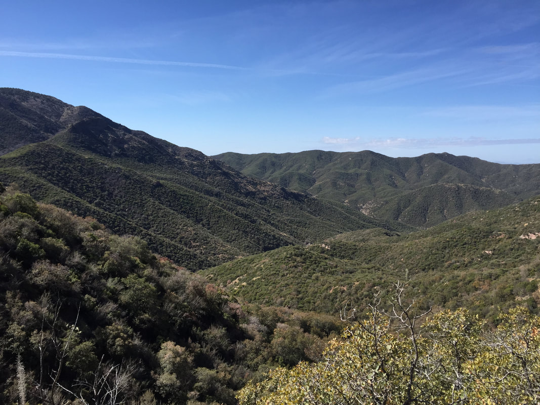
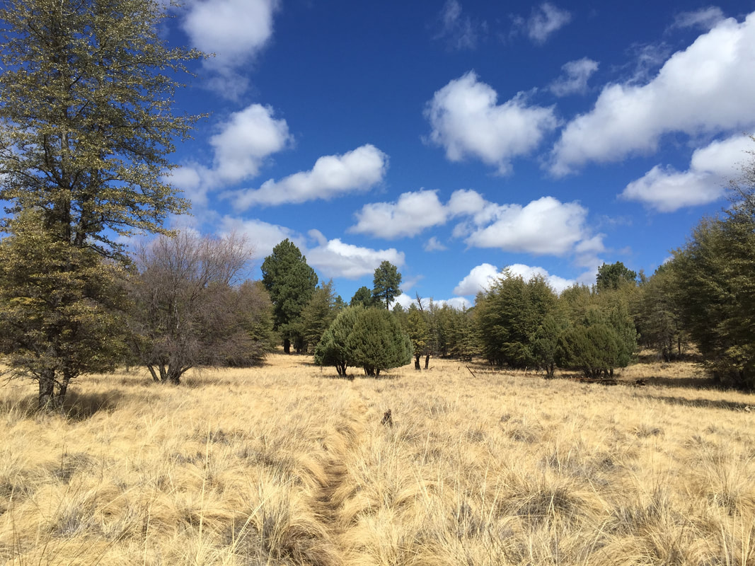
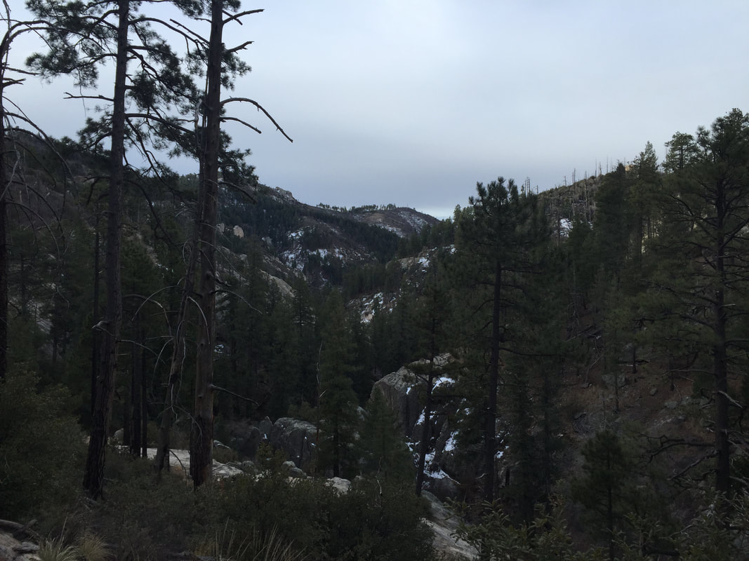
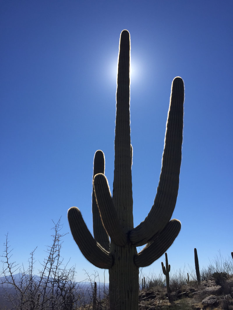
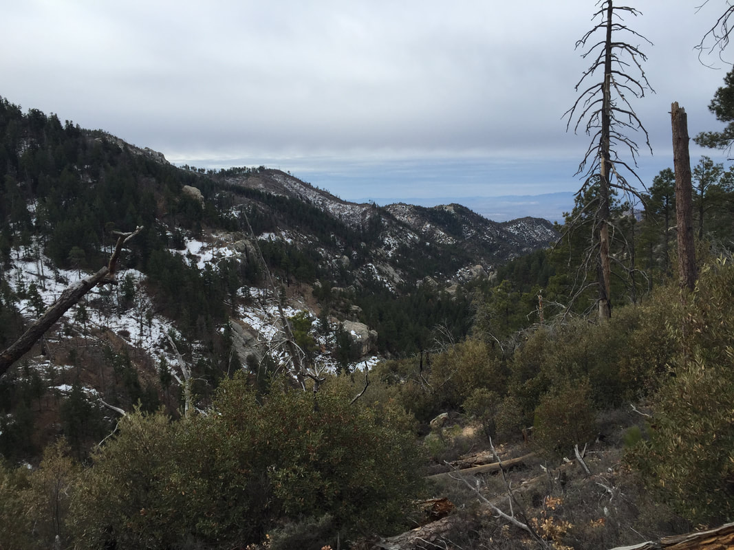
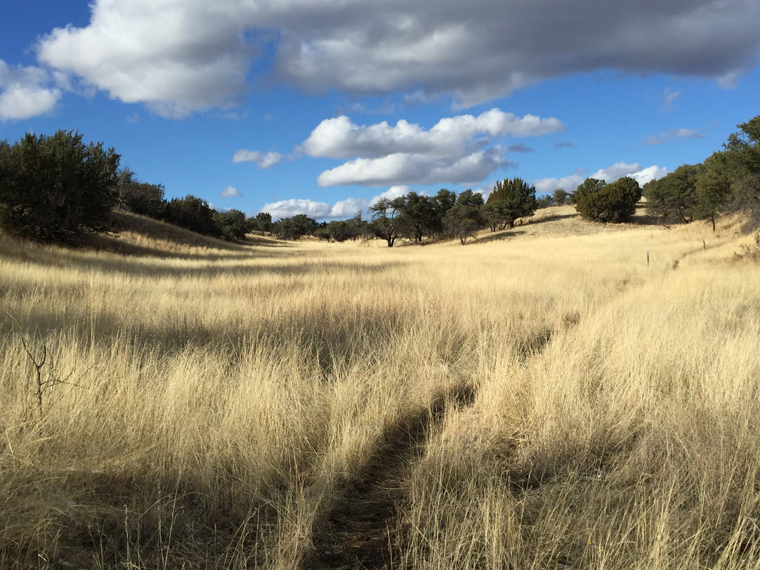
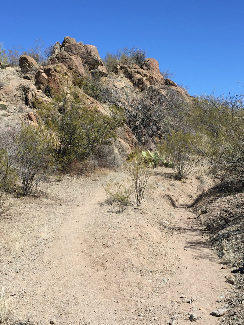
Northern Arizona is significantly different than southern Arizona. The hiking is completely different, too. For some reason, I was expecting northern Arizona to be more difficult. I figured that since I was climbing up and staying up in elevation, it would be much harder. Turns out, the opposite was true. Once the trail gets up to 7000 feet in the northern Arizona section, it stays up. So gone are the steep ups and downs, slides into narrow canyons, and grueling slogs in the sun. Instead, the northern Arizona section winds through the trees, with soft duff beneath your feet, with reliable water sources. 
Picture
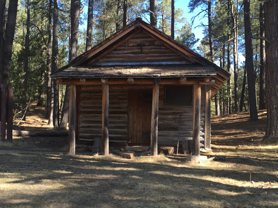
The first day out of Pine, in the Blue Ridge section, the trail passes a historic cabin (General Springs Historic Cabin), parallels General Cook Trail for a while ( a wagon supply route for Fort Apache) and crosses near a historic monument (Battle of Big Dry Wash). So in addition to hiking, you could be playing cowboys and indians in your head. 
Picture

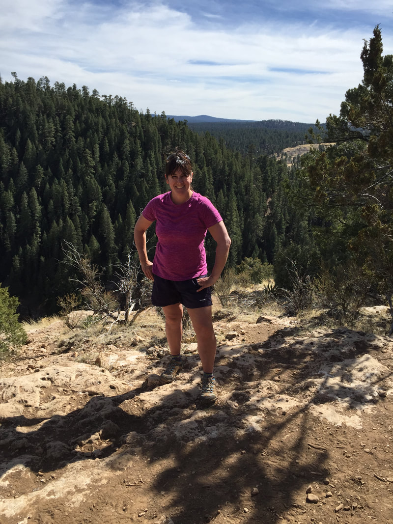
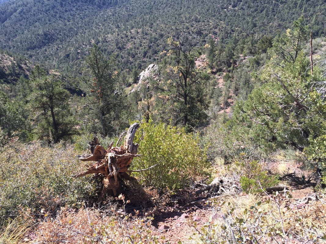
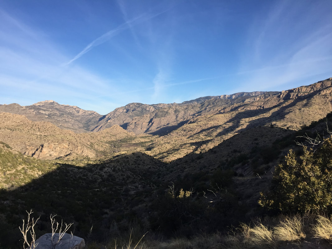
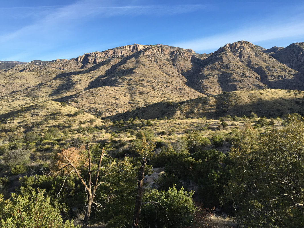
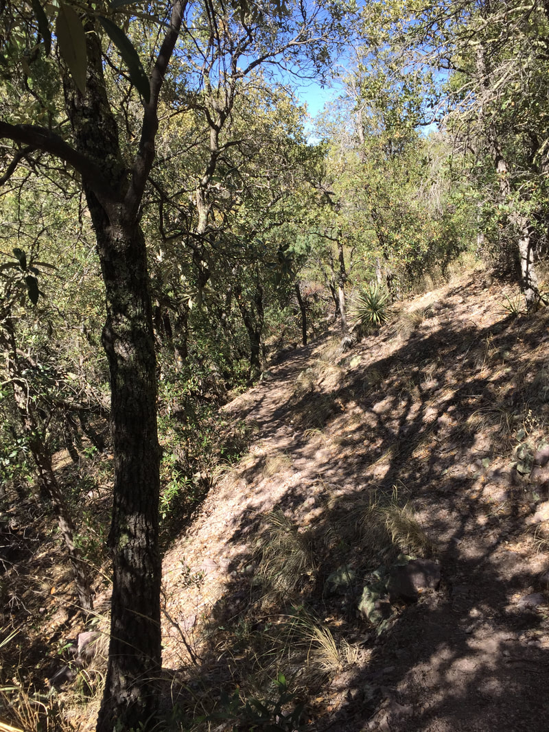
When in the forest, its true that the views are not as spectacular, there is  definitely a different  energy. Maybe its just love emanating from the trees.  I quite enjoy it. Plus, the trees offer a bit of sun protection, so the hiking is a bit easier. All in all, it made for quick, easy, enjoyable hiking. 
Picture

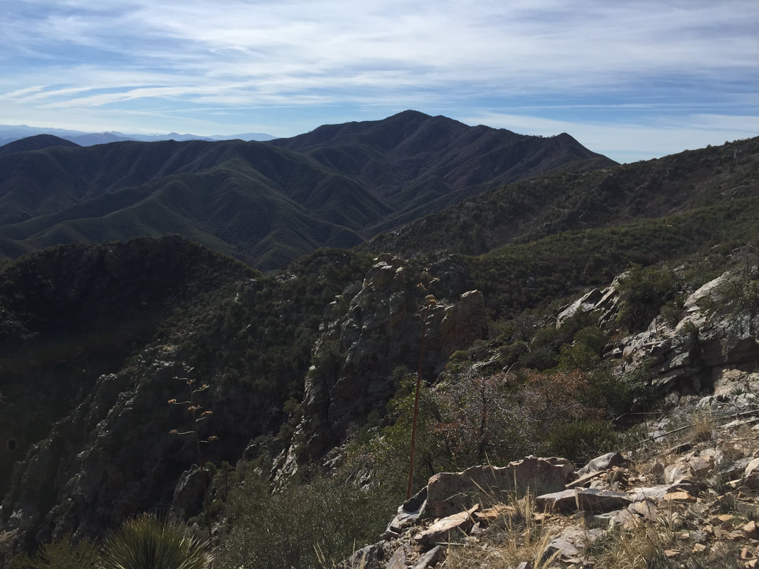
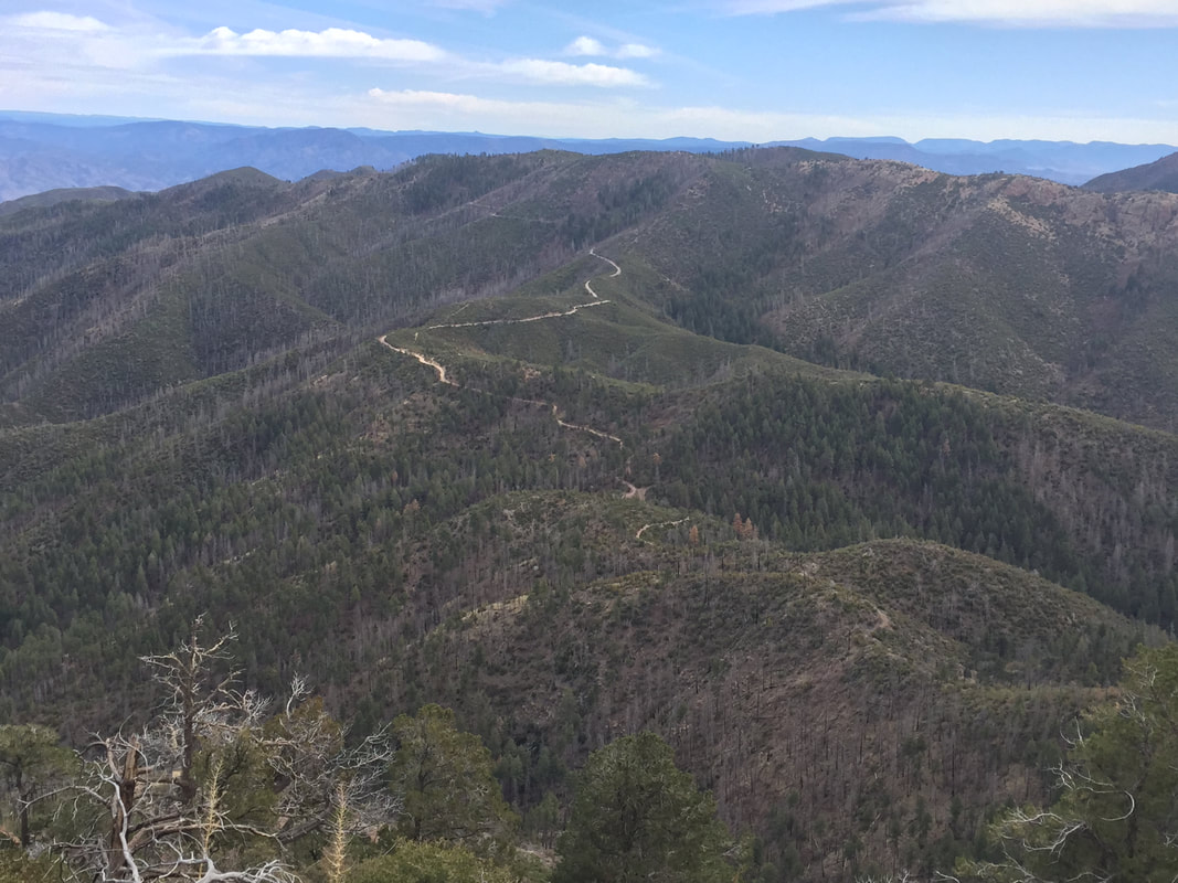
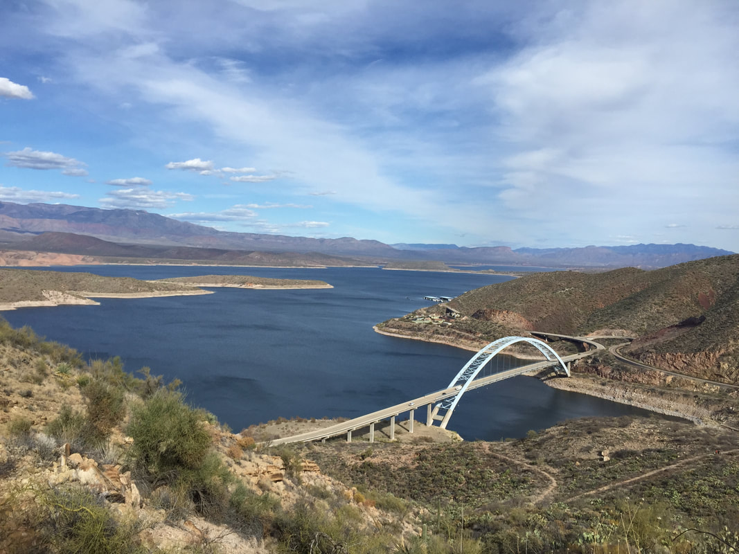
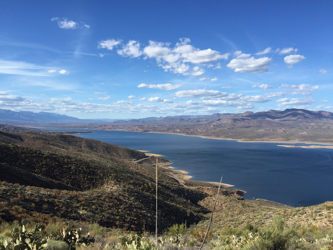
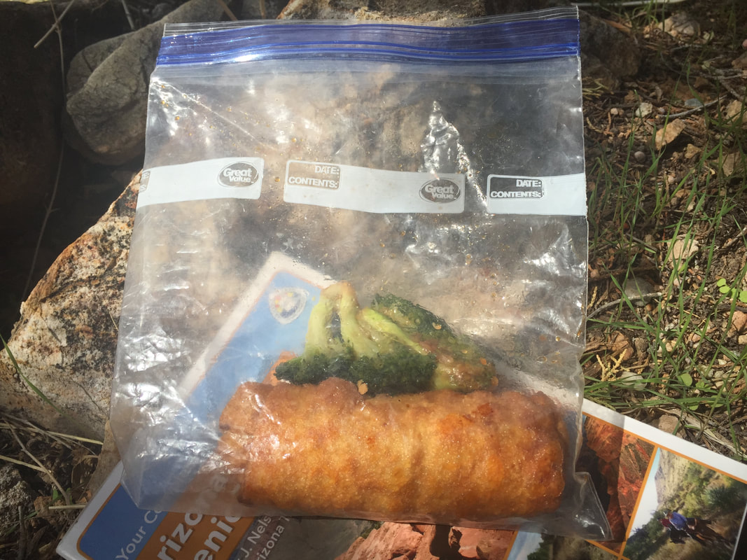
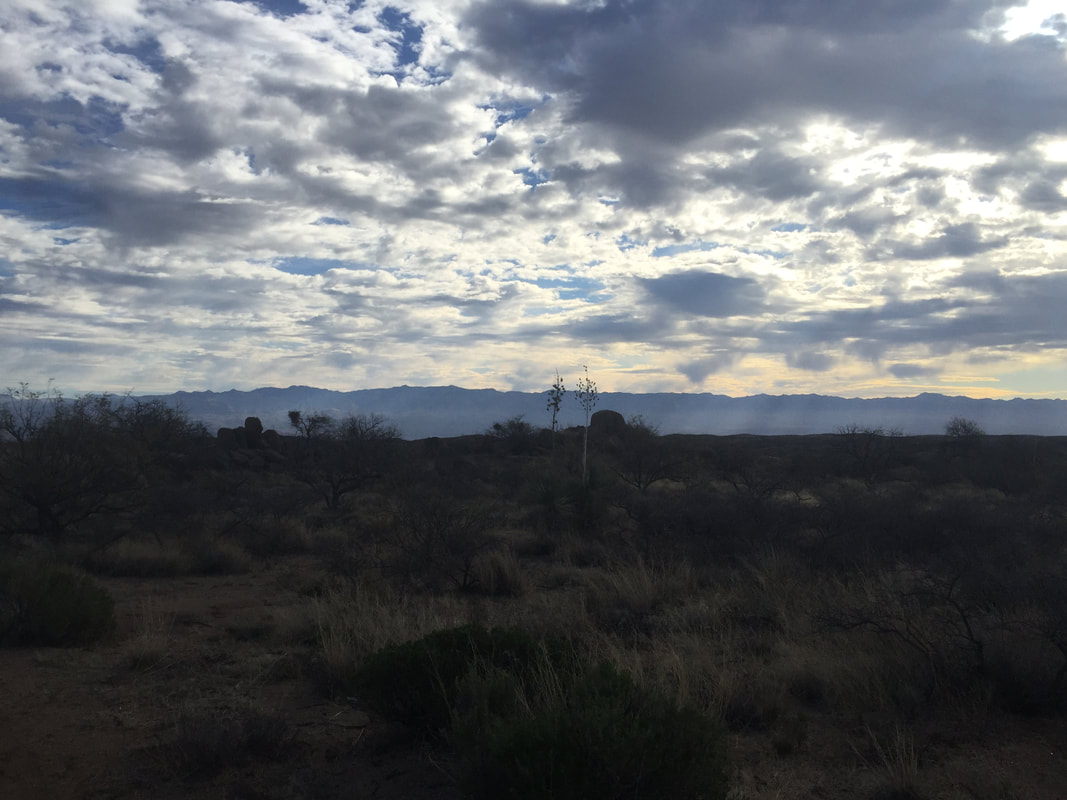
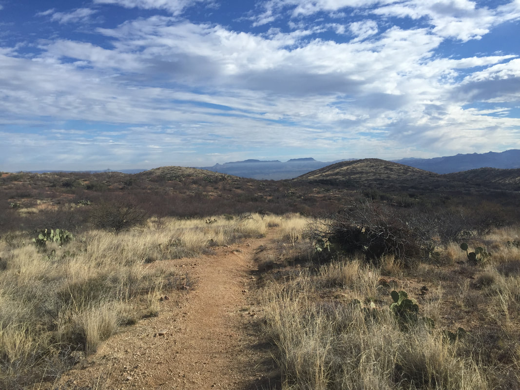
The whole leapfrogging with the car scenario was really great and really ridiculous at the same time. Great because I was still meeting lots of people and doing little side trips to see the nearby historical sites and views from Mogollan Rim. Ridiculous, because the forest road drives between trailheads were often 3 times longer than the hike between trailheads. (ON the AT and PCT the opposite was true). No matter. It was still super fun. 

​
Picture
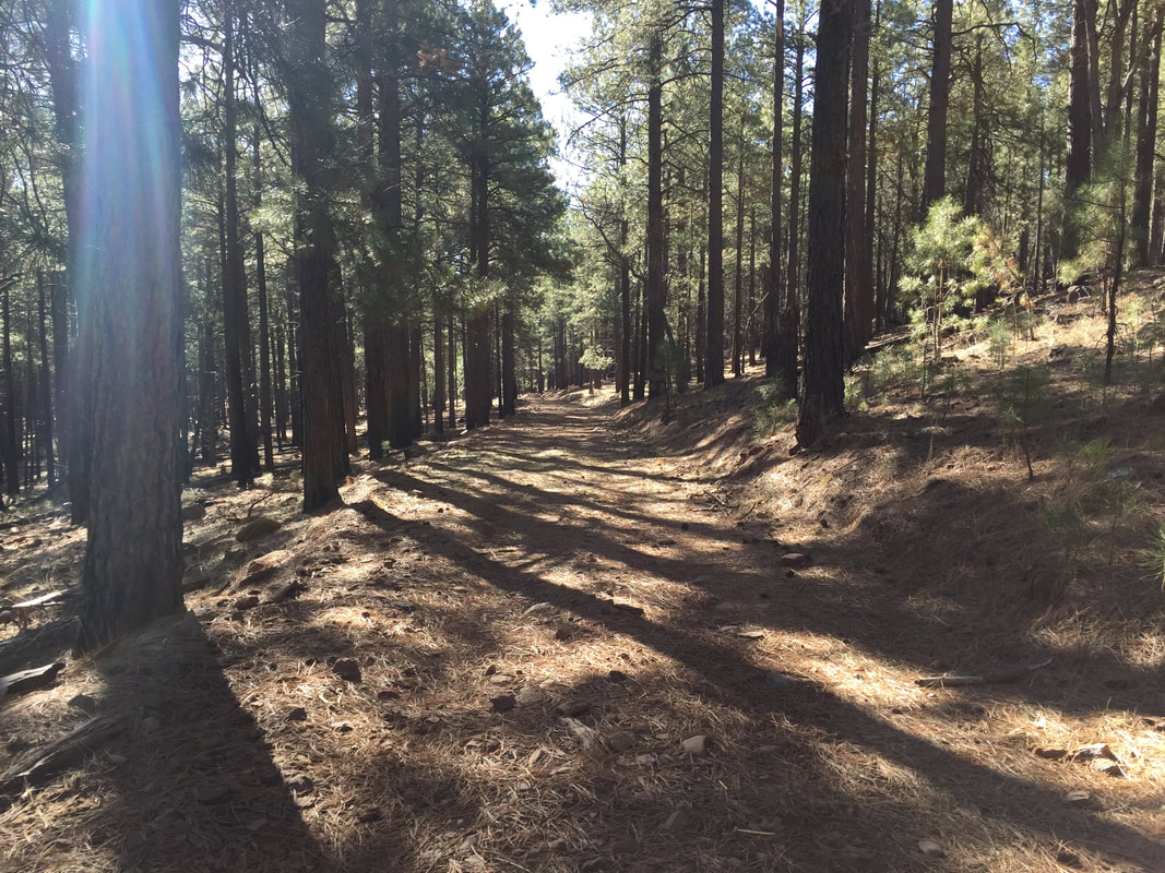
In this easier, cooler, shady section, I also started to do a little bit of running. Since I only had the daypack, there wasn't as much weight to worry about. It felt really good- I hadn't been able to run since I twisted my knee at the gym before Christmas. But it seems that hiking all day does wonders!  So I walk/ran through Happy Jack and Mormon Lake.

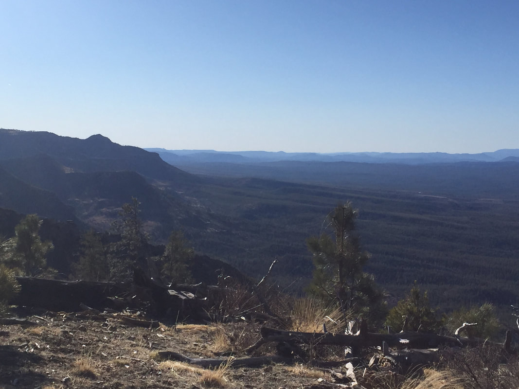
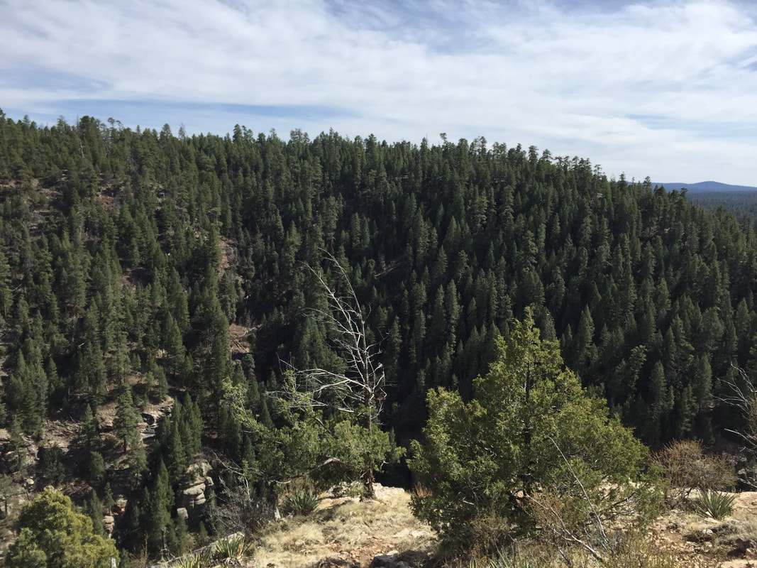
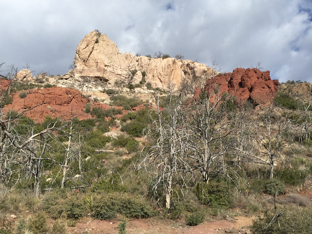
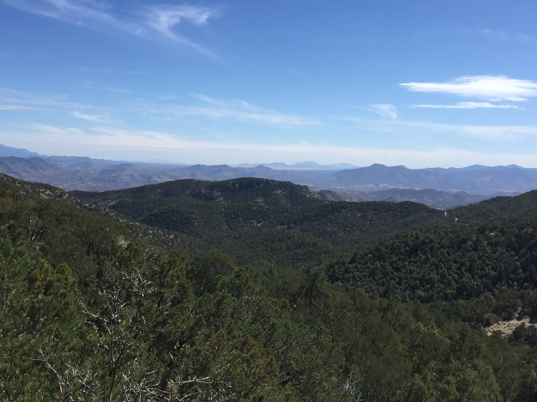
Just south ( and east) of Flagstaff was Walnut Canyon.  Such spectacular views!  The resupply route of the trail veers west and goes into Flag, taking an urban route through the streets. But since I had a car for resupply, I could stick to the canyon and get more of the great views. I enjoyed Walnut Canyon so much that I went to the nearby national monument and checked out the cliff dwellings.  
Picture
Picture

And then it was into Flagstaff and into April.
0 Comments

Pine

4/11/2018

0 Comments

 
I was now entering the Northern Arizona section, starting with the town of Pine. Pine proved to be the best trail town I had experienced yet, even exceeding Oracle. 

Just prior to hitting town, the trail goes through a nice, dense forest of ponderosa pine with great views of Oak Spring Canyon.  (the locals told me about a great swimming hole at the bottom of Oak Spring Canyon, but it was not warm enough for swimming as of yet) It was a really nice morning. 
Picture

In town, about a half mile past the trailhead was a great little place called THAT Brewery.  They had micro-brews, great food, free wifi, and even little cabins out back that hikers could rent for the night.  Outside, they had volleyball and corn hole, but it was a bit cool and windy when not hiking.  Inside, I found Pumpkin and Road Runner!  We had some food, and then I gave them a ride to the laundromat, we went to the grocery store for resupply, and explored the town a little. When the laundry was done, we all went back to THAT Brewery.

While Pumpkin and Road Runner were staying in one of the cabins, I had other plans: a friend of a friend lived in Pine. She had been following my hike on instagram and Facebook and had offered a shower and a bed at her place. So after work, Deb met us at the brewery for dinner. 
Picture
ROAD RUNNER, ME, PUMPKIN, and DEB

Deb had a great house- a renovated A-frame cabin in the woods. She also had a dog who did not like me much (he was a rescue dog who had been abused when he was little and was very protective of the house). I felt bad that he had to be locked in the bedroom, but he kept growling at me!  Anyway, I had a great, warm shower and a great warm bed.

In the morning, we had breakfast and Deb headed to work while I headed for the trail.  I did a fantastic 16 mile out and back ( RR and P were hanging in Pine for the day) on easy trail with great views.  The trail was really looking wonderful for northern Arizona!
Picture
When I got back to the trailhead, I decided to go back to the brewery to eat before heading to the next trailhead.  I had the best macaroni and cheese of my life! Super happy and uncomfortably full, I put the jeep in drive and said goodbye to Pine. 
0 Comments

Back in the Driver's Seat

4/11/2018

0 Comments

 
Everything changed once I got the jeep back.

I STARTED MEETING MORE PEOPLE AGAIN

 In the Four Peaks Wilderness section, I met 5 guys from Arkansas (who I dubbed "The Blues Brothers" because they were all wearing blue) who were sectioning from Sunflower south to Superior. (they were having trouble with the elevation, but otherwise were doing well).  Then I met 2 hikers in their 80s out for a day hike. They had spent the previous weekend in Flagstaff teaching Boy Scouts how to light fires and LNT principles. They had been trail stewards for a long time and were great to talk to.
​
Picture
In the Saddle Mountain section, I met 4 retired guys who called themselves "The Oldtimer's Club."  They were out four wheeling in the forest roads and had stopped at the trailhead to take a look around. They insisted on sharing their hard boiled eggs and oranges with me after I knocked out my morning miles. 
Picture
In the Mazatzal Divide section, I met some trail runners who suggested a good loop hike for the upcoming Red Hills section. And best of all, in the Pine Mountain section, I met some other thru hikers!! I met Pumpkin and Road Runner as they were filtering water and we chatted a bit.  (they had a much better experience at Roosevelt Lake. They got in at 1:00 and the store was still open. The restaurant/bar stayed open until 5 and they got all the cheeseburgers they wanted!)  I would continue to run into Pumpkin and Road Runner off and on for the rest of the trail.

I TOOK SOME SIDE TRAILS

At the suggestion of the two older hikers, I took a side trail to the top of one of Lone Pine Saddle (one of the four peaks) in exchange for the 8 mile walk along the dirt road.

In the Red Hills,  I did the City Creek Loop instead of an out and back hike. 

In doing so, I got some fantastic views and nice trail hiking while skipping some sections where I would essentially have been road walking. And speaking of roads....
Picture
I EXPLORED THE ARIZONA BACKROADS

 Arizona has an extensive network of well maintained dirt roads that criss-cross the wilderness areas in the state. There are tons of trailheads for hiking, mountain biking, and riding ATVs. Since I haven't  really pushed the jeep since I got it (well, except for that time I pulled a Chevy Silverado out of the Salt River last summer) I looked forward to seeing what the renegade was made of. I felt pretty badass driving out in the middle of nowhere down steep, winding roads. Well, I DID feel pretty badass until I saw a 2-wheel drive Nissan going by in the other direction. No matter. It was probably a local who knew the roads really well and clearly didn't care about their car. 

One thing is for sure: driving around the dirt roads was more fun than walking dirt roads
Picture

THE TRAILHEADS WERE FUN

Unlike the small towns, Sundays on the trailheads were the best days! Most often, when I left to hike in the early morning, my car was the only one in the trailhead parking area. But when I got back in the afternoon, there were 10, 12, sometimes 20 cars. Often we all were coming back to the cars at the same time- hikers, bikers, climbers with crash-pads strapped to their backs, sometimes equestrians too. We'd all talk and compare adventures as we peeled off our socks and shoes and wiped the dust from our faces.  Once somebody pulled a cooler out of the back of an SUV, and everybody grabbed a drink- an impromptu tailgate party!!  And since adventure lovers tend to be a busy bunch, impromptu parties last 20 minutes at most, before people are hopping into their cars to get to the next trailhead, the next challenge, or back home to get ready for work the next day. But those short-lived connections make trail life more fun.

I hadn't realized how much I valued the connections on the trail as an essential part of thru-hiking. It's much easier to deal with minor annoyances (such as closed stores or nocturnal visiting animals)  when you have somebody else to experience it with. It's more likely to end in eye rolls and a shared joke. When you are going it alone, though, those minor annoyance escalate in your mild to major catastrophes.  

Being back in the driver's seat allowed me to forge some of those trail connections and put me in control.

However, it was pretty clear that this endeavor was no longer a purist thru-hike. I now officially was calling my quest a "Hybrid-hike".  Not what I originally had in mind. But I was having fun. 
0 Comments

Hakuna Matata

4/9/2018

0 Comments

 
The trail away from Roosevelt Lake climbed sharply and paralleled the road for a little over a mile. Then it dropped down to the road and I walked across a suspension bridge. I don't generally enjoy walking across bridges with traffic going by. But you gotta do what you gotta do.

After the bridge, once again, the trail started climbing. (after all, I had come down 6000 feet in elevation that day, I needed to get back up again!) Fortunately, there were lots of graded switchbacks, not the steep slide into a canyon like the day before.  I was passed by a couple of day hikers out for a short afternoon hike. 

"Wow!" I said "The views here are spectacular!"

"Just wait," the said. "It gets even better."
Picture
I had been thinking I'd hike to the next trailhead to camp, but I was feeling pretty tired after the strenuous day. The day hikers, upon their return, assured me that there was a full water cache at the trailhead. And I, not wanting to race the sunset yet again, decided to leave the water as a treat for myself in the morning. I stopped early and enjoyed the sunset as I ate dinner. Early to bed, and happy for a good night's sleep.
Picture


BOOM!  I was jolted awake, my trekking poles were clattering together and my tent was shaking. "What the?"

BOOM! It happened again. Something was bumping my tent! 

I grabbed my headlamp and shined it out, yelling out "Hey! Get outta here!" I heard feet running away. Ok. that should do it. I put my light away and went back to sleep.

BOOM!  It was back. Some animal, whatever it was, was bumping my tent again. I had scared it away, but not for long. What the heck was this thing's problem? And what kind of animal bumps tents?  It was not going after my food (normal animal behavior). It was not chewing on my sweaty bandana (disgusting, but normal animal behavior). It was not rummaging through my stuff and trying to climb into my pack (annoying, but normal animal behavior). No, it was BUMPING MY TENT! Again, I shined my light out, yelled, and this time banged on my cook pot noisily. It ran away.

For a while. 

And then it was back. Over and over again, all night long. 

Can I tell you- when something bumps your tent in the middle of the night, you go from completely asleep to completely awake instantaneously.  Heart pounding, gasping, jumping up and yelling into the night. In between the tent-bumping-animal-visits, I slept fitfully with unnerving dreams. I dreamed I was being stalked by a mountain lion. I dreamed I was stuck in the Blair Witch Project. I dreamed of Leonardo Dicaprio riding his horse off a cliff and then sleeping inside its carcass. I dreamed of the Walking Dead.

When morning came, I felt horrible.  I was exhausted and sleep deprived. My quads, feet, and shins were sore. I had a headache. I was battered and bruised from falling on my way down the steep canyon. And I was still a little upset that I was denied a cheeseburger yesterday.   

Picture

I lay in my tent for a while, willing myself to get up, dressed, and break down camp. To start climbing again, and to get myself to the water at the trailhead. I did no want to do it. I did not want to put my pack on, I did not want to climb. I did not want to do this. I just wanted a cold drink and a frickin cheeseburger. This was no longer fun.

Past through hiking experience has taught me that when you start to feel like this, a town day is generally in order. I was only 4 miles from the road. I got up, put my pack on, and walked back down the hill to the road. 

I got a ride into town in about 5 minutes, found a hotel with vacancies, and checked in. I took a shower, climbed in bed, and slept for about 2 hours. Then I went out for food. But I didn't get a cheese burger. I got a burrito. 

After talking to people in town, at the hotel, and the guy who gave me a ride into town, I am pretty confident that the animal bumping my tent was either a javelina or a coati.
Picture

Javelinas apparently are very territorial and have pretty poor eyesight. They can be a bit aggressive if they feel threatened. And several people relayed that javelinas regularly bumped trashcans, shed, or cars.
Picture
Coatis kind of look like weird raccoons. They apparently act a bit like raccoons, too. They are curious and mischievous. And 2 hunters told be that they had a coati JUMP on their tent repeatedly during the night. 

So there you have it. I was being terrorized the night before by either Pumbaa or Timon. 

After a bit of sleep and some food, I felt a lot better. I did want to keep hiking. But I DIDN'T want to be subject to the whims of small town store clerks who decided to close early on a whim. (This had actually happened to me a couple other times before Roosevelt Lake) I was going back for the car. No problem.
0 Comments

The Superstition Mountains

4/8/2018

0 Comments

 
The Superstition Mountains were beautiful and brutal. I loved and hated them. For me, they were the southern Maine of the Arizona Trail. 

Going north from Picketpost, I was lucky enough to have cooler temperatures (high 60's) and overcast skies. Perfect hiking weather!  The trail started out moderately, winding through desert scrub and crossing multiple dirt roads where I was people on ATVs out for some fun. The climb was very gradual, and as the trail climbed, the view of Picketpost Mountain was ever changing, from a giant monolith that dominated the southern horizon to a flat-topped table that the trail looked down upon. 
Picture
Water in this section was scarce, but the reports from earlier hikers confirmed that the springs and rivers were still flowing. The low temps and cloud cover helped keep my water consumption in check. Around 2, I reached a reliable source, Mud Spring. Despite its name, the spring was clear and clean with good, cold water. Even so, I double treated the water, since hikers were not the only ones who used this spring. 
Picture
It was  nice spot for a break: water, shade, flat, comfortable spots to sit, and a light, steady, breeze. Plus, I had packed the best kind of trail lunch: a post-town-day-lunch! 
Picture
After Mud Spring, the trail began a steep climb, rising 5000 feet in 6 miles. I powered through the 5 miles like I was on a mission. There were several nice looking camp sites along the climb with beautiful views that probably would have made for a nice night. But I was in a get-er-done kind of a mindset. I figured I'd knock out that  climb so I wouldn't have to worry about it tomorrow. I'd figure out a camp site once I was on top of the ridge. 

Picture
Along the way, I crossed paths with an older hiker by the name of "Trail Dale."  

"Wait,", I said, "I think I've hear of you. Are you on a couple backpacker groups on Facebook?"

Turns out, he had heard of me, too. Funny how you meet people scrolling around the web on the lookout for new adventures. I assured Trail Dale that he was close to the spring and that the water was fine. Then we went out separate ways. 

Once I completed the arduous climb, I realized the error of my ways. Though the elevation profile flattened out at the top of the climb, it actually had given way to ridge walking and then to road walking along a dirt road.  Neither of which makes for great camping! So I found myself racing the sunset, looking for a campsite or possibly making it all the way to the next trailhead before dark.  Fortunately, I did find a good spot off the road just as darkness settled in.  Lesson learned: if the sunset if approaching and you find a pristine campsite, ditch your climb-to-the-top mission and set up the tent!!

The next morning, I broke camp and continued walking along the road to the trailhead. The trail angle who had given me a ride to the trail the day before had described this trailhead to me: it was 90 minutes to 2 hours of driving down a bumpy, winding dirt road. Yet when I arrived, I saw at lead 20 cars parked! Arizona peeps certainly like their outdoors and will go to great length to experience it!

I got some water at the trailhead (lots of gallon jugs placed there) and talked to another hiker. He was doing the LOST trail and going southbound. He was hoping to catch up with Dale that day, and I assured him that Dale had expressed his intensions of camping about 7 miles from where we were. If he kept a good pace, he'd catch Dale by the afternoon. 
Picture
Today, I was set to pass through Reavis Ranch, a ranch that had been fully operational in the early 1900s,  but had since been abandoned. There were still fruit trees, which could supply a treat in the late summer or early fall, and there were old, rusty tools lying around. Plus, the foundations of the old buildings were there, as well. It was a cool place to explore. I passed 3 boy scout troops on my way to Reavis, as they headed back to the parking area. Apparently, Reavis is a popular destination to camp.

There was a group of people with metal detectors out on the ranch when I got there, searching for rare artifacts, I suspect. I was only searching for water and shade, both of which were in available at the ranch. I hung out, ate some lunch, and chatted it up with the treasure hunters for an hour or so before I put my hiking shoes back on. 
Picture
Just beyond Reavis Ranch, the trail started to get HARD. Loose rocks, steeps up-and-downs, and uneven ground was the rule from here on out. There were a few places where I had to tuck my poles in my pack and climb around on all fours to get through.  

Right around here, I ran into a blast from the past- a hiker I had hiked with a bit on the Appalachian Trail!  Ledge was south bounding through here, on a trail that led from downtown Phoenix, into the Superstitions, and down to Tucson.  "Man, this trail is hard!" he said. "I'm doing considerably less milage than I thought I would." Me too. 

At first, I didn't recognize Ledge. Cause, here's the deal, hiker chicks maintain their overall individual look for the most part. I've recognized Honey Badger, Fancy Feet, Pony Bear, and Mama Goose without a problem. Hiker dudes, on the other hand...once they start growing that beard, they pretty much all look like Grizzly Adams and are hard to distinguish from one another. Sorry dudes! It's true.
Picture
Around here, I came to a section that put yesterday's climb to shame. I came to a steep, narrow, canyon that I'd have to descend and then climb back out of. In 2 miles, I descended 2000 feet on loose, rocky, terrain. It sucked! The rocks kept rolling out from under my feet and I'd slide. Sometimes I was able to catch myself, but sometimes I couldn't. I fell 7 or 8 times on the descent. When I finally reached the bottom, I briefly considered camping in the canyon, but then I took a look around. It was about 30 feet wide with a wash and thousands of prickly pear cactus. No place to camp here! And so I walked to the other side and stared the climb out. 
Picture
And for the second time in 2 days, I found myself huffing it up a steep climb, racing the sunset for a camping spot. This time, when I found a spot ALMOST at the top (oh, so close!) I abandoned the climb and pulled out the tent.  It was a perfect flat spot next to a juniper tree. The tree had branches on the opposite side, but no branches facing the trail. The existing branches kind of curved around, forming a tree-cave. Perfect for blocking out the wind (I was between 6 and 7 thousand feet). I set up the tent right in the tree-cave.

It's a good thing I did, too. The wind picked up in the middle of the night and sounded like a freight train! When I got up to go to the bathroom in the middle of the night, I saw that it had started raining. And when I woke up in the morning, I saw that the rain had turned to snow. I was well protected in this camp spot.

So today, I started the day dressed in every piece of clothing in my pack. Hat, gloves, plastic bags over the gloves, leggings, insulation layer, puffy jacket, and rain gear on top.  I finished the climb with sideways snow pummeling me in my face and the mantra "I'm dropping elevation today, I'm dropping elevation today" in my head.

As I dropped in elevation, I went from sideways snow in the face, to sideways hail in the face, to wet, heavy rain-snow mix, to Forrest Gump "little-itty-bitty-stinging-rain", to mist, to fog, to sun.  Funny how that happens. And as I went down, the layers came off. By 11 am, I was down to convertible pants and a t-shirt.

Today was a hard day- 7000 feet of elevation drop total, but with the up-and-down dirt roads that I eventually ended up on, it was probably more like 10,000 feet of elevation change for the day. My nose was running, my head was pounding, and my shin was throbbing from my falls yesterday. But- I was heading into a town today!

Roosevelt Lake was a small town, but it had a little marina that had a general store and a restaurant. Previous hikers had raved about the cheeseburgers there. So through the rain and hail and itty-bitty-stinging rain, through the up and down terrain, and through the many, many gates I had to cross through (they are often VERY hard to open and close and were becoming the bane of my existence) I kept myself going with the promise of a thick, juicy cheeseburger and a cold drink.

Luckily, I reached Roosevelt Lake by 1:30 pm.  The restaurant and store were open until 3. I was golden!

Except that they weren't open until 3. I rolled into town at 1:30 as they closed and locked the door. 

"Oh,", I said. "I thought you were open. The sign says 3."

The store clerk looked at me incredulously. "It's a slow day!" she said. "Do you actually expect us to stay open until 3 on a slow day?" 

Um, yeah, actually. I do. But I said. "Oh. Ok. Thanks anyway."

 I shouldered my pack and headed back to the trail. 
Picture
0 Comments

Superior

4/3/2018

0 Comments

 
Picketpost Trailhead, outside of Superior was everything the last trailhead was not. It had bathrooms, well stocked water caches, parking, and camping. There were RV spots and two campground hosts who kept the water caches full and offered hikers rides into town.

I hung out and talked to the hosts when I arrived, talking about my plans for the next two days. The trail guide suggested that the really nice viewpoints on the trail were about 15 miles south of Picketpost Trailhead. I figured I'd head out with the full pack, hike around 15 miles and set up camp to sight see and take pictures. Then, I'd hike back in the next day. The hosts were REALLY helpful, in that there were no viable camp spots 15 miles out. My best bet would be to set up camp at mile 12, just past the gate, and backtrack the extra 3 miles without the full pack. GOOD TO KNOW!!
Picture

The toughest part of this section of trail was the lack of natural water sources, followed by the HEAT! It would be a hot, dry trudge. I filled up with 3 liters of water before hitting the trail.   

Hiking south from Picketpost, the trail meandered around the west side of Picketpost Mountain, a spectacular looking sight that dominated the view for miles. It's kind of a strange looking, flat topped mountain, but spectacular nonetheless. It was a quite a sight.

Eight miles into the hike, I came to a life-saver for the hikers on this trail: Forrest Road 4. Rugged, steep, and uneven, FR 4 is impassible unless you have a high-clearance 4WD or an ATV.  But just off FR 4, where it meets the Arizona Trail, is a resupply box.  Kind trail angels come out in their high clearance trucks and ATVs and restock the box with gallons and gallons of water. A couple people even left their cell numbers, encouraging hikers to text if they were in trouble and needed an emergency ride into town. Forrest Road 4 was the perfect place to stop, eat something, and top off my water bottles. 

Picture
 After FR4, the trail climbed a bit more, crested a ridge, and then dropped down into a valley. It was easy to see how this valley would look in higher-snow-years.  There was a still-green grassy patch with trees and a dry river bed. In higher precipitation years, this would be an oasis! Not so this year. But it was still quite pretty. 

After a steep climb out of the valley, the trail wound around a ridge and then joined a dirt road that lead up to a gate. This was the gate the trailhead hosts had been talking about. I scouted around for a while and decided that the best camping spot was about .1 miles past the gate, up a hill, on the top of a small crest.  The dirt road had clearly not been used in several years- it was in a state of complete disrepair- but was also clearly popular with equestrians. ( I had to choose my tent site carefully, away from horse bombs!)  Later, I would realize how great this tent site was, when the sun set and the stars came out. 
Picture
It was unusual, but kind of nice to have camp set up while the sun was still in the sky. Usually, I hike until sunset, and its a mad scramble to set up camp, change, and make dinner before darkness falls. Today was both leisurely and quite decadent!
Picture
In the morning, I got dressed, grabbed a small day-bag with water and some snacks, and left the rest of camp as is. Then I backtracked toward the ridgeline and canyon that was back another 3 miles. The views did not disappoint! There were cool spire-like rock formations, steep drop offs with views below, and a little green patch I dubbed "the fairy ring" in my head. Like the valley from yesterday, there was still some green left and it was easy to see how it would look in higher snow years.
Picture
Picture
Picture
After my 7 mile out and back, I arrived back to break down camp, load up the big pack, and start back toward Picketpost.  While it had been cool and pleasant around sunrise, the temperature was quickly rising and I tried to go as quickly as I could.  

I once again stopped at FR4 for a little rest and water. This time, I only took about a half liter of water. Generally, when looking at reliable water sources, I strive to have about a half liter left when I hit the next source. Especially when dealing with caches. I try not to hog the water at water caches, knowing that a lot of people will becoming after me and will be relying on that water.

Today, rather than having a half liter left when I reached Picketpost, I instead ran out of water a half mile away.  Still, I'm chalking that one up to perfect planning. I can easily walk a half mile without water. Running out 6 miles away, however, may have posed a problem.
Picture
Once back at the trailhead, I took advantage of the abundant water, restroom facilities, and snack offerings from the camp hosts.  Heading back toward Superior, I offered rides to a couple of scraggly looking hikers, but it turns out they were just really scruffy day hikers, not thru-hikers!

After this great section, I ate some wonderful Mexican food in Superior, and then headed back to put the jeep back in storage. It was time to get back into thru-hiker mode and hit the Superstition Mountains like a champ!
0 Comments

Kearny

3/31/2018

0 Comments

 
After my crazy long day hike, I allowed myself to sleep in until the ungodly hour of 6:00 am. I had originally thought I would drive to the Freeman Trailhead, hike to Kearny, and then get a shuttle back to the trailhead to get my car. However, after the drop-off the day before, I realized that I would never find the trailhead on my own, even with navigation. Plus, to get to the trailhead, you have to drive PAST Oracle, and then another 45 minutes or so on dirt roads in the middle of nowhere. That was bit much to ask of anyone.

I quickly changed my plans to drive to the Gila River (the Kearny trail exit) and do a southbound in-and-out hike. Then, I would hike north and shuttle back from Superior to Kearny. Much more doable!

So I left the Tiger Mine Trailhead in Oracle, stopped at the local breakfast place (where all the locals pegged me as a hiker despite my "town clothes" because of the distinctive hiker hobble in my gait) for some delicious peach crepes. Then I headed up to the Gila River. 
Picture
When I got there, I was in for a surprise. There was a major construction project going on- building a new, much bigger bridge over the river. For the time being, the old bridge is still in use, but there is new road construction on either side and detours down to the bridge. Much of the hillside is torn up with the temporary road and detours as well as the new roads. And the trailhead I was going to? Gone. Or relocated. Or in the plans to be re-established at a later date. Whatever. I'd have to change my plans again. 

I was able to find a small spot to park the car by the bridge for the southbound out and in. But I wouldn't be able to leave it there overnight. I did a nice 15 mile out and in hike in overcast, slightly drizzly weather and decided to visit Kearny to see what it was all about. Weirdly, I found every business establishment to be closed . Maybe because it was Sunday? Whatever. I was having no luck today. I'd drive on to Superior. 
0 Comments

Oracle

3/23/2018

0 Comments

 
As I finished up my slack pack adventure of Mount Lemon and moved into Oracle, I was considering my options of continuing with the slack packing or putting the jeep back in storage to go back to traditional thru-hiking. Though the first few sections of Mt Lemon worked out well, the last section was a bit of work: I camped halfway up the mountain because the higher elevation campgrounds were still closed for the winter. In the morning, I drove up to the higher elevation and parked at the gate of the (closed) Marshall Gulch picnic area. I walked a half mile down the road to the trail and back-tracked south on the trail for an hour and a half, turned around and returned to the picnic area. Then, I drove the road-walk in Summerhaven (pretty much all closed for the winter) and parked a half mile from the (closed) Oracle Ridge trailhead. I walked around the gate and walked north on the trail for two hours, turned around, and returned to the trailhead. Finally, I had to drive back down Mt Lemon from the other side (Control Road, which goes down the back side directly to Oracle is not maintained and also is closed in the winter), drive through Tucson and around to Oracle to the American Flag Ranch Trailhead where I backtracked south for an hour and a half, turned around, and walked back to the trailhead. 

Even after all this creative driving and moving around and hiking in and out, and even though I put in19 miles that day, I feel like I didn't walk much of this section at all. I saw some nice views, I got some fresh air, but I didn't get the real gist of this section, which was essentially a long, slow descent. And while part of me was happy that I didn't experience "all those awful rocks!" as some other hikers described, another part of me was feeling like I wasn't really walking this trail at all.

It was getting time to put the jeep back in storage. 
Picture
That would not happen in Oracle, though. Oracle is small and out of the way for a car exchange.

Oracle is, however, home to the Chalet Village Motel, probably the friendliest place on trail. Marie and her husband are the proprietors and they are super hiker friendly. I had sent a resupply box there and after my day of hop-scotching around to different trailheads, I got my box and got a room at the Chalet.

I reunited with many of the hikers I had met on Mt Lemon: Dan, the Bills, Allen, and Steve. Most were taking a zero day after the hard descent. I decided to do a short day on the 9 mile section that began and ended in Oracle. In the morning, I drove to American Flag Ranch Trailhead and did a quick 9 miles to the Tiger Mine Trailhead on the other side of town. I got a hitch back to the motel from a lady driving a convertible with a cat riding next to her by the stick shift. The cat was standing on her hind legs with her forefeet on the dashboard, watching the scenery go by and getting her fur blown around in the wind. When I got in the car, she promptly jumped in my lap and I had a friend for the short drive back to the motel. Around noon, when "The Three Amigos" were hitting the trail, I rode with them to the trailhead to fetch my car.
Picture
I spent the afternoon resting, doing laundry, organizing my resupply stuff, and eating Mexican food. One thing this trail has is delicious Mexican food in every single little town. Good stuff!

The next day, I decided to challenge myself. A BIG slack pack! Early in the morning, I dropped the jeep off at the Tiger Mine trailhead and got a ride to Freeman trailhead with Marnie. She was picking up a couple hikers who were having a difficult time and wanted to come back into town for some rest. The Freeman Trailhead is way out in the middle of nowhere. We drove for an hour down winding dirt roads out into the middle of the desert floor. There was a trail angel (whose name I cannot recall now) hanging out at the trailhead in his RV with water, food, and a satellite phone for emergencies. (The community on this trail is amazing!) I said hello to everyone and started hiking southbound- back to the jeep. 

​Today would be a 28 mile day.  
Picture
Picture
Picture
It was a perfect day for a long hike! The temps were in the cool high 60s, there was just enough cloud cover to make the sun bearable. It sprinkled a couple times, but never really fully rained. Couldn't ask for a better day.

Over the course of the day, I passed 5 of my northbound fellow hikers; The Three Amigos who had started the day before at American Flag Ranch, and later the two Bills, who had decided to hike together. Both Bills are pretty hard core ultra-light: base weight of 5 and 7 pounds respectively, and both striving for 25-30 mile days pretty much every day on the trail. The younger Bill is doing the AZT as a "warm-up" for the PCT.  ("Dude", I told him "If you are doing 25 miles on the AZT, you'll be banging out 45 to 50 mile days on the PCT!" ) Apparently, that's what he had in mind- he's going to attempt a PCT yo-yo in 2018. (Hiking northbound and then turning around to hike the whole thing again southbound).  The older Bill (Yoda) was using the AZT as a "warm up" for the Colorado Trail later on this year. What is it with these warm up hikes? 

​
Picture
As for me, I'll be perfectly happy with just the one long distance hike this year.  

And the marathon + day? Went great. I got back to my car about 15 minutes after darkness fell (just a little hiking by headlamp). Got out of my hiking clothes and into my camp clothes, made some dinner, and got all settled down for sleep about 20 minutes before the real rain started falling. Perfect day! 
0 Comments

Slacker Girl

3/15/2018

0 Comments

 
In Tucson, I sat pondering my conundrum:  I was about to enter Saguaro National Park. You need a back-country permit to camp within the park boundaries. Though I had filled out a form, I had never heard back about the permit. When I began the hike, I just figured that I'd just put in a long day and go in and out of the park in one day. Now, it had become clear that this was not a viable option. After my hard first day, where I got fatigued and disoriented and lost and the hard climb where I walked only 13 miles in one day, I was seeing that this trail was harder than I had anticipated. And those sections were rated as "moderate" in the trail guide. The upcoming section was rated as "strenuous" and I would have to hike 22 miles straight up and then straight back down in order to get in and out of the park in one day. That was just not going to happen. I was in a pickle.
​
**** Later on,  I learned that I really didn't need to get so worked up. It seems that the rangers in Saguaro are fairly lenient when it comes to thru hikers. We thru-hikers roll into camp at sundown, set up camp, eat and go right to sleep. Then, camp is packed up and we are out of there before sunrise.  Plus, I would have been in the park on a Sunday night, not traditionally a high volume day for campsites. Other hikers had just printed out their permit request, even though they didn't have the actual permit to show rangers. Oh well. I was in full-blown freak out mode, though, so I made a different decision. *******

 I decided to slack pack the next section. 

Picture
I took a shuttle back up to Cottonwood Storage, got the jeep out of storage, and spent the next section doing  out-and-in hikes with just a day pack. The trail guide had nice suggestions for turn around points (I usually tried to go a couple miles beyond the turn around points) as well as directions to trail heads and parking spots to begin and end the sections.  

In some ways, I felt like I was cheating. I wasn't hiking every single mile of trail (though I was generally hiking MORE miles than if I had just hiked straight through). On the other hand, I was having a really good time. 
Picture

When I was just hiking through, I wasn't really meeting many thru hikers. I saw people on the trail, sure. I saw day hikers and mountain bikers and equestrians and, of course, border patrol agents. Just not many thru hikers. When I started the out and back slack pack hikes, I started meeting thru hikers. 
Picture

Plus, I think this helped with my lack of conditioning. By putting high miles with low weight on my feet for the next several days, I built up my endurance on the steep sections, without killing myself. 
Picture

After hiking up and back down Mica mountain in Saguaro National Park, I drove around to Mount Lemon where I set up camp in a fairly busy campsite for two nights. I walked south from the campsite on day one ( I ended up hiking almost the entire section in and out) and then north from the campsite day two out and back. Plus, I didn't have to break down the tent. And I had some nice camping neighbors who shared chocolate with me! 
Picture

It was interesting. As I came into contact with other thru-hikers, they all were saying the same thing: "Wow, this is kind of a lonely trail."  Even though I met 4-5 hikers, they were all about a half day apart. Just far enough to not encounter one another on the trail. 
Picture

I kind of feel like, had I not been slack packing, I would have been a bit down in the dumps, myself. I would have been right in the middle of the half-day-in-between-hikers bubble and I would not have met Bill and Mike and Dan and Steve and the other Bill. I would have ben a lot more lonely than I was as a slack packer. 
Picture

So even though my execution of the hike over Mica Mountain and Mount Lemon was NOT what I had originally planned, I think it was the right decision for me. 

Maybe I should always be a slacker-girl! 
Picture
0 Comments

Patagonia to Vail

3/14/2018

0 Comments

 
The next stretch of trail would take me from the trailhead outside Patagonia to Vail. It would be a beautiful, though solitary endeavor.

After bidding Al and Nellie goodbye, I started up the trail. Like many sections of the Arizona Trail, this was an existing trail that would connect to other trails either previously existing, or specially made AZT sections. The trail was really a back country road, steep and rough and rocky. It was labelled a "forest jeep road" in the guide book, but I certainly wouldn't take MY jeep on it. The only vehicles I saw on this road were ATVs, the buggy-style ATVs that you can rent for fun. And it did look like fun on the ATV. Unfortunately, it wasn't nearly as fun on foot. All those steep rises and whoop-do-dos and soft sand made for hard hiking. I was pretty disappointed to see that at the end of a long day of hard hiking, I only had 13 miles under my boots! Fortunately, the beautiful views made up for the arduous climbing.
Picture
Picture
Picture

I was quite happy to find a nice, established camp spot off a dirt road. It had ample flat ground, a fire pit (though I did not light a fire. I just set up camp, ate, and passed out), and a water source close by in the form of a river. It was a comfortable camp.

Around 2 am, when I woke up to go to the bathroom ( I wish I could sleep through the night without getting out of the tent!) I heard soft pitter pattering on the tent.

"Oh," I thought, it's sprinkling out"

Once I unzipped my vestibule, I saw that it wasn't raining, it was in fact, snowing! My tent was covered with about and inch of fluffy, white stuff. So after I did my business, I took a few minutes to shake off the tent. I also took a moment to be grateful that I had decided upon my free standing tent, instead of my lightweight, single layer tent. Had I gone the other way, I would at the very least be dealing with condensation inside the tent or worse still, a collapsed tent. Thank goodness!

​ In the morning, I took a bit longer than usual to break down camp and get going. I was waiting for the snow to slow down. Plus, it was just so cozy in the sleeping bag! I eventually got myself motivated and broke down camp as the snow dwindled, though never quite stopped. It was interesting to see what nocturnal visitors I had, who had left their prints in the snow. A deer, a rabbit, chipmunk or squirrel, and a fox. All of whom appeared interested in my food bag. 
Picture

I hiked along, all my insulating layers under my rain gear until I reached a trail head about 7 miles away, my stopping point for a mid morning snack.  While I munched on my Cliff bar,  a border patrol truck rolled up. It was the first of several visits I would have from border patrol that day. The officer got out to make sure I was okay, not suffering from hypothermia, that I had enough water, food, and layers. And to give me the option to bail and head back to town and a warm bed, if I wanted. It's nice to feel looked after! 

After the trailhead, the trail took a little detour and followed along a system of pipes that were built in 1904 as a way of carrying water to Kentucky Camp, a mining operation headquarters. Kentucky Camp has several buildings including a visitor center and a rental cabin. 

I arrived and pulled out my wet tent, hanging it over a couple saw-horses on the porch of the visitors center to dry. Then I went inside to check out the displays and eat some lunch. My timing could not have been more perfect! As soon as I got inside, the wind picked up and snow started flying. I sat inside, eating my lunch and watching the snow outside. After about and hour, it cleared as suddenly as it had started. I packed up my stuff, shouldered my pack, and continued on my way. 
Picture

Back out on another dirt road, I encountered another border patrol agent, checking on my well being. We chatted briefly and then went our separate ways. After a brief climb, I crested a high point and began a long, gradual descent to lower elevation. As the elevation dropped, the temperature rose. By the time I stopped for an afternoon break, I had shed the rain gear and my mid layer. I encountered a trail runner and mountain biker in the late afternoon, for after-work training runs. And I once again found a perfect little camp-site for my needs.  No snow that night, just a giant, spectacular full moon!
Picture
Picture
Picture
Picture
 
The final day of this leg could not have been any more different. The trail continued to drop in elevation so that much of the day was right on the desert floor. My concern now was not staying warm and dry, but instead staying cool, getting adequate sun protection, and keeping and eye on water. 
Picture
Picture
Picture
I ended this leg of the journey at Colossal Cave State Park, in Vail. Though I had originally planned on just picking up a resupply box and moving on, I was dreaming of a shower. So I got a ride into Tucson for a night of rest, laundry, and showering. Life is good. 
0 Comments
<<Previous

    Heather

    Hi, I'm Heather, AKA "Pink Lady". Welcome to my blog.  I'm so excited to share my adventures as I embark on a thru-hike of the Pacific Crest Trail.  
    While you're here, be sure to check out  the charity I'm hiking for: Devoted2Children a  great organization which funds a home for orphaned children in Haiti. 

    Archives

    November 2015
    October 2015
    September 2015
    August 2015
    July 2015
    June 2015
    May 2015
    April 2015
    March 2015
    November 2014
    May 2014
    April 2014
    November 2013
    October 2013
    September 2013
    August 2013
    July 2013
    June 2013
    May 2013
    April 2013
    March 2013

    Categories

    All
    Adaptive Sport
    Hiking Recap
    Preparation
    Rock Stars
    Trail Peeps
    Training

    RSS Feed

    Where I am
Powered by Create your own unique website with customizable templates.
Photo from symphony of love