The Superstition Mountains were beautiful and brutal. I loved and hated them. For me, they were the southern Maine of the Arizona Trail.
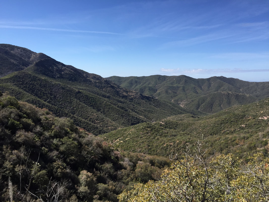
Going north from Picketpost, I was lucky enough to have cooler temperatures (high 60's) and overcast skies. Perfect hiking weather! The trail started out moderately, winding through desert scrub and crossing multiple dirt roads where I was people on ATVs out for some fun. The climb was very gradual, and as the trail climbed, the view of Picketpost Mountain was ever changing, from a giant monolith that dominated the southern horizon to a flat-topped table that the trail looked down upon.
Going north from Picketpost, I was lucky enough to have cooler temperatures (high 60's) and overcast skies. Perfect hiking weather! The trail started out moderately, winding through desert scrub and crossing multiple dirt roads where I was people on ATVs out for some fun. The climb was very gradual, and as the trail climbed, the view of Picketpost Mountain was ever changing, from a giant monolith that dominated the southern horizon to a flat-topped table that the trail looked down upon.
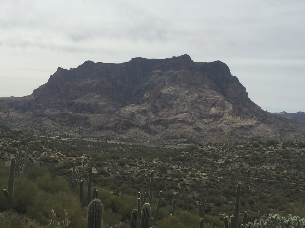
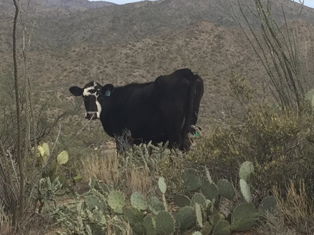
Water in this section was scarce, but the reports from earlier hikers confirmed that the springs and rivers were still flowing. The low temps and cloud cover helped keep my water consumption in check. Around 2, I reached a reliable source, Mud Spring. Despite its name, the spring was clear and clean with good, cold water. Even so, I double treated the water, since hikers were not the only ones who used this spring.
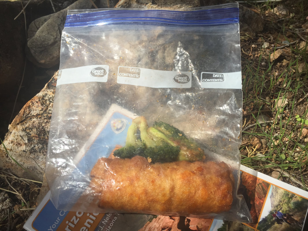
It was nice spot for a break: water, shade, flat, comfortable spots to sit, and a light, steady, breeze. Plus, I had packed the best kind of trail lunch: a post-town-day-lunch!
After Mud Spring, the trail began a steep climb, rising 5000 feet in 6 miles. I powered through the 5 miles like I was on a mission. There were several nice looking camp sites along the climb with beautiful views that probably would have made for a nice night. But I was in a get-er-done kind of a mindset. I figured I'd knock out that climb so I wouldn't have to worry about it tomorrow. I'd figure out a camp site once I was on top of the ridge.
Along the way, I crossed paths with an older hiker by the name of "Trail Dale."
"Wait,", I said, "I think I've hear of you. Are you on a couple backpacker groups on Facebook?"
Turns out, he had heard of me, too. Funny how you meet people scrolling around the web on the lookout for new adventures. I assured Trail Dale that he was close to the spring and that the water was fine. Then we went out separate ways.
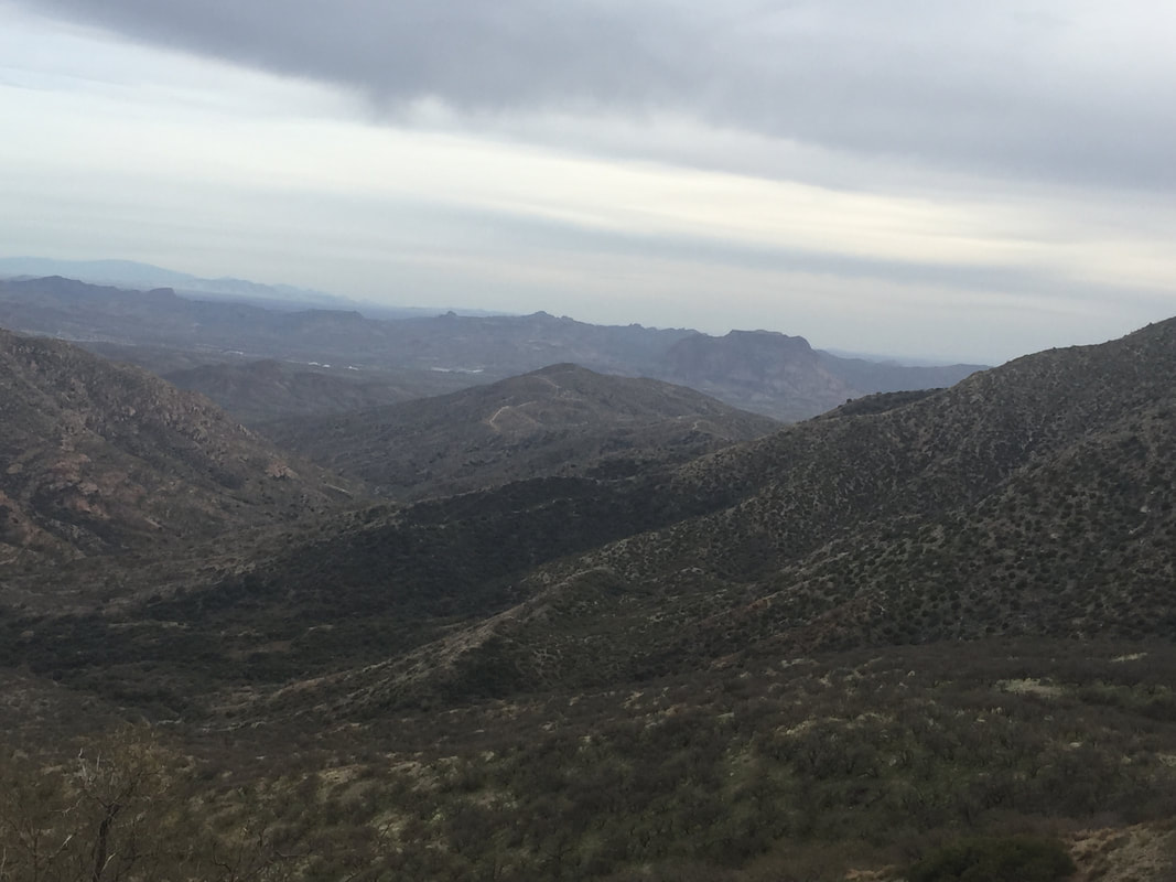
Once I completed the arduous climb, I realized the error of my ways. Though the elevation profile flattened out at the top of the climb, it actually had given way to ridge walking and then to road walking along a dirt road. Neither of which makes for great camping! So I found myself racing the sunset, looking for a campsite or possibly making it all the way to the next trailhead before dark. Fortunately, I did find a good spot off the road just as darkness settled in. Lesson learned: if the sunset if approaching and you find a pristine campsite, ditch your climb-to-the-top mission and set up the tent!!
The next morning, I broke camp and continued walking along the road to the trailhead. The trail angle who had given me a ride to the trail the day before had described this trailhead to me: it was 90 minutes to 2 hours of driving down a bumpy, winding dirt road. Yet when I arrived, I saw at lead 20 cars parked! Arizona peeps certainly like their outdoors and will go to great length to experience it!
I got some water at the trailhead (lots of gallon jugs placed there) and talked to another hiker. He was doing the LOST trail and going southbound. He was hoping to catch up with Dale that day, and I assured him that Dale had expressed his intensions of camping about 7 miles from where we were. If he kept a good pace, he'd catch Dale by the afternoon.
"Wait,", I said, "I think I've hear of you. Are you on a couple backpacker groups on Facebook?"
Turns out, he had heard of me, too. Funny how you meet people scrolling around the web on the lookout for new adventures. I assured Trail Dale that he was close to the spring and that the water was fine. Then we went out separate ways.
Once I completed the arduous climb, I realized the error of my ways. Though the elevation profile flattened out at the top of the climb, it actually had given way to ridge walking and then to road walking along a dirt road. Neither of which makes for great camping! So I found myself racing the sunset, looking for a campsite or possibly making it all the way to the next trailhead before dark. Fortunately, I did find a good spot off the road just as darkness settled in. Lesson learned: if the sunset if approaching and you find a pristine campsite, ditch your climb-to-the-top mission and set up the tent!!
The next morning, I broke camp and continued walking along the road to the trailhead. The trail angle who had given me a ride to the trail the day before had described this trailhead to me: it was 90 minutes to 2 hours of driving down a bumpy, winding dirt road. Yet when I arrived, I saw at lead 20 cars parked! Arizona peeps certainly like their outdoors and will go to great length to experience it!
I got some water at the trailhead (lots of gallon jugs placed there) and talked to another hiker. He was doing the LOST trail and going southbound. He was hoping to catch up with Dale that day, and I assured him that Dale had expressed his intensions of camping about 7 miles from where we were. If he kept a good pace, he'd catch Dale by the afternoon.
Today, I was set to pass through Reavis Ranch, a ranch that had been fully operational in the early 1900s, but had since been abandoned. There were still fruit trees, which could supply a treat in the late summer or early fall, and there were old, rusty tools lying around. Plus, the foundations of the old buildings were there, as well. It was a cool place to explore. I passed 3 boy scout troops on my way to Reavis, as they headed back to the parking area. Apparently, Reavis is a popular destination to camp.
There was a group of people with metal detectors out on the ranch when I got there, searching for rare artifacts, I suspect. I was only searching for water and shade, both of which were in available at the ranch. I hung out, ate some lunch, and chatted it up with the treasure hunters for an hour or so before I put my hiking shoes back on.
There was a group of people with metal detectors out on the ranch when I got there, searching for rare artifacts, I suspect. I was only searching for water and shade, both of which were in available at the ranch. I hung out, ate some lunch, and chatted it up with the treasure hunters for an hour or so before I put my hiking shoes back on.
Just beyond Reavis Ranch, the trail started to get HARD. Loose rocks, steeps up-and-downs, and uneven ground was the rule from here on out. There were a few places where I had to tuck my poles in my pack and climb around on all fours to get through.
Right around here, I ran into a blast from the past- a hiker I had hiked with a bit on the Appalachian Trail! Ledge was south bounding through here, on a trail that led from downtown Phoenix, into the Superstitions, and down to Tucson. "Man, this trail is hard!" he said. "I'm doing considerably less milage than I thought I would." Me too.
At first, I didn't recognize Ledge. Cause, here's the deal, hiker chicks maintain their overall individual look for the most part. I've recognized Honey Badger, Fancy Feet, Pony Bear, and Mama Goose without a problem. Hiker dudes, on the other hand...once they start growing that beard, they pretty much all look like Grizzly Adams and are hard to distinguish from one another. Sorry dudes! It's true.
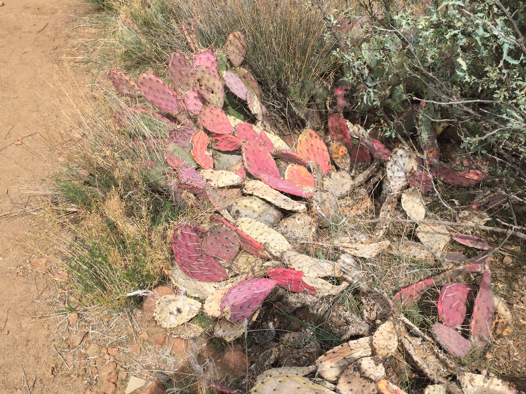
Around here, I came to a section that put yesterday's climb to shame. I came to a steep, narrow, canyon that I'd have to descend and then climb back out of. In 2 miles, I descended 2000 feet on loose, rocky, terrain. It sucked! The rocks kept rolling out from under my feet and I'd slide. Sometimes I was able to catch myself, but sometimes I couldn't. I fell 7 or 8 times on the descent. When I finally reached the bottom, I briefly considered camping in the canyon, but then I took a look around. It was about 30 feet wide with a wash and thousands of prickly pear cactus. No place to camp here! And so I walked to the other side and stared the climb out.
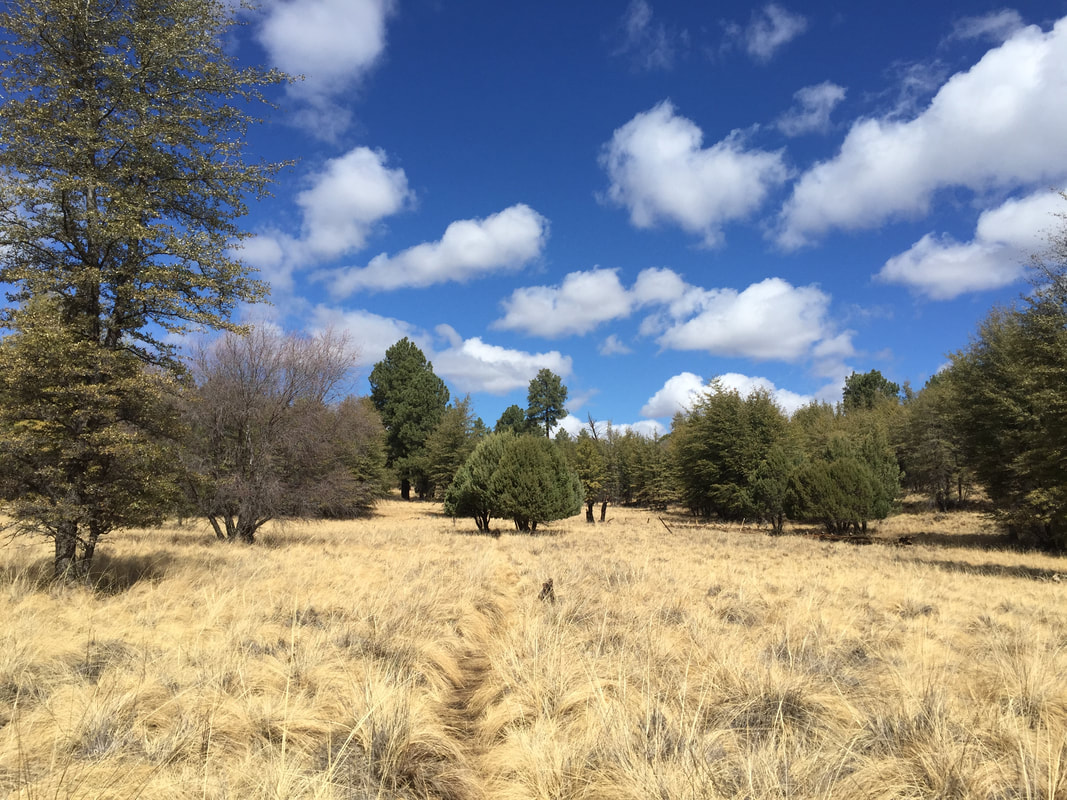
And for the second time in 2 days, I found myself huffing it up a steep climb, racing the sunset for a camping spot. This time, when I found a spot ALMOST at the top (oh, so close!) I abandoned the climb and pulled out the tent. It was a perfect flat spot next to a juniper tree. The tree had branches on the opposite side, but no branches facing the trail. The existing branches kind of curved around, forming a tree-cave. Perfect for blocking out the wind (I was between 6 and 7 thousand feet). I set up the tent right in the tree-cave.
It's a good thing I did, too. The wind picked up in the middle of the night and sounded like a freight train! When I got up to go to the bathroom in the middle of the night, I saw that it had started raining. And when I woke up in the morning, I saw that the rain had turned to snow. I was well protected in this camp spot.
So today, I started the day dressed in every piece of clothing in my pack. Hat, gloves, plastic bags over the gloves, leggings, insulation layer, puffy jacket, and rain gear on top. I finished the climb with sideways snow pummeling me in my face and the mantra "I'm dropping elevation today, I'm dropping elevation today" in my head.
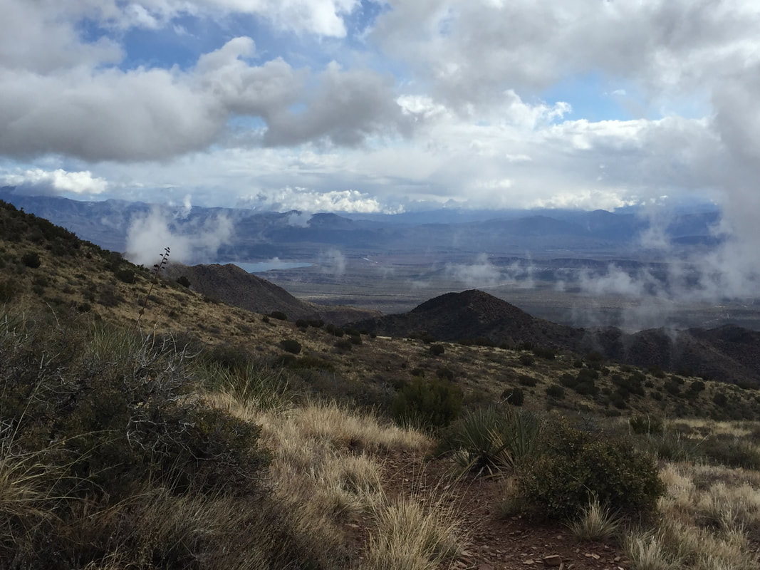
As I dropped in elevation, I went from sideways snow in the face, to sideways hail in the face, to wet, heavy rain-snow mix, to Forrest Gump "little-itty-bitty-stinging-rain", to mist, to fog, to sun. Funny how that happens. And as I went down, the layers came off. By 11 am, I was down to convertible pants and a t-shirt.
Today was a hard day- 7000 feet of elevation drop total, but with the up-and-down dirt roads that I eventually ended up on, it was probably more like 10,000 feet of elevation change for the day. My nose was running, my head was pounding, and my shin was throbbing from my falls yesterday. But- I was heading into a town today!
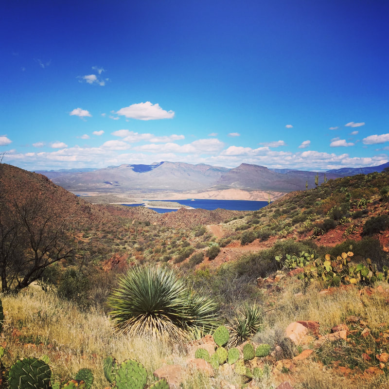
Roosevelt Lake was a small town, but it had a little marina that had a general store and a restaurant. Previous hikers had raved about the cheeseburgers there. So through the rain and hail and itty-bitty-stinging rain, through the up and down terrain, and through the many, many gates I had to cross through (they are often VERY hard to open and close and were becoming the bane of my existence) I kept myself going with the promise of a thick, juicy cheeseburger and a cold drink.
Luckily, I reached Roosevelt Lake by 1:30 pm. The restaurant and store were open until 3. I was golden!
Except that they weren't open until 3. I rolled into town at 1:30 as they closed and locked the door.
"Oh,", I said. "I thought you were open. The sign says 3."
The store clerk looked at me incredulously. "It's a slow day!" she said. "Do you actually expect us to stay open until 3 on a slow day?"
Um, yeah, actually. I do. But I said. "Oh. Ok. Thanks anyway."
I shouldered my pack and headed back to the trail.
It's a good thing I did, too. The wind picked up in the middle of the night and sounded like a freight train! When I got up to go to the bathroom in the middle of the night, I saw that it had started raining. And when I woke up in the morning, I saw that the rain had turned to snow. I was well protected in this camp spot.
So today, I started the day dressed in every piece of clothing in my pack. Hat, gloves, plastic bags over the gloves, leggings, insulation layer, puffy jacket, and rain gear on top. I finished the climb with sideways snow pummeling me in my face and the mantra "I'm dropping elevation today, I'm dropping elevation today" in my head.
As I dropped in elevation, I went from sideways snow in the face, to sideways hail in the face, to wet, heavy rain-snow mix, to Forrest Gump "little-itty-bitty-stinging-rain", to mist, to fog, to sun. Funny how that happens. And as I went down, the layers came off. By 11 am, I was down to convertible pants and a t-shirt.
Today was a hard day- 7000 feet of elevation drop total, but with the up-and-down dirt roads that I eventually ended up on, it was probably more like 10,000 feet of elevation change for the day. My nose was running, my head was pounding, and my shin was throbbing from my falls yesterday. But- I was heading into a town today!
Roosevelt Lake was a small town, but it had a little marina that had a general store and a restaurant. Previous hikers had raved about the cheeseburgers there. So through the rain and hail and itty-bitty-stinging rain, through the up and down terrain, and through the many, many gates I had to cross through (they are often VERY hard to open and close and were becoming the bane of my existence) I kept myself going with the promise of a thick, juicy cheeseburger and a cold drink.
Luckily, I reached Roosevelt Lake by 1:30 pm. The restaurant and store were open until 3. I was golden!
Except that they weren't open until 3. I rolled into town at 1:30 as they closed and locked the door.
"Oh,", I said. "I thought you were open. The sign says 3."
The store clerk looked at me incredulously. "It's a slow day!" she said. "Do you actually expect us to stay open until 3 on a slow day?"
Um, yeah, actually. I do. But I said. "Oh. Ok. Thanks anyway."
I shouldered my pack and headed back to the trail.
 RSS Feed
