Picketpost Trailhead, outside of Superior was everything the last trailhead was not. It had bathrooms, well stocked water caches, parking, and camping. There were RV spots and two campground hosts who kept the water caches full and offered hikers rides into town.
I hung out and talked to the hosts when I arrived, talking about my plans for the next two days. The trail guide suggested that the really nice viewpoints on the trail were about 15 miles south of Picketpost Trailhead. I figured I'd head out with the full pack, hike around 15 miles and set up camp to sight see and take pictures. Then, I'd hike back in the next day. The hosts were REALLY helpful, in that there were no viable camp spots 15 miles out. My best bet would be to set up camp at mile 12, just past the gate, and backtrack the extra 3 miles without the full pack. GOOD TO KNOW!!
I hung out and talked to the hosts when I arrived, talking about my plans for the next two days. The trail guide suggested that the really nice viewpoints on the trail were about 15 miles south of Picketpost Trailhead. I figured I'd head out with the full pack, hike around 15 miles and set up camp to sight see and take pictures. Then, I'd hike back in the next day. The hosts were REALLY helpful, in that there were no viable camp spots 15 miles out. My best bet would be to set up camp at mile 12, just past the gate, and backtrack the extra 3 miles without the full pack. GOOD TO KNOW!!
The toughest part of this section of trail was the lack of natural water sources, followed by the HEAT! It would be a hot, dry trudge. I filled up with 3 liters of water before hitting the trail.
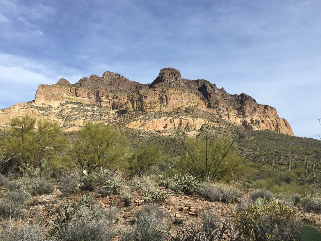
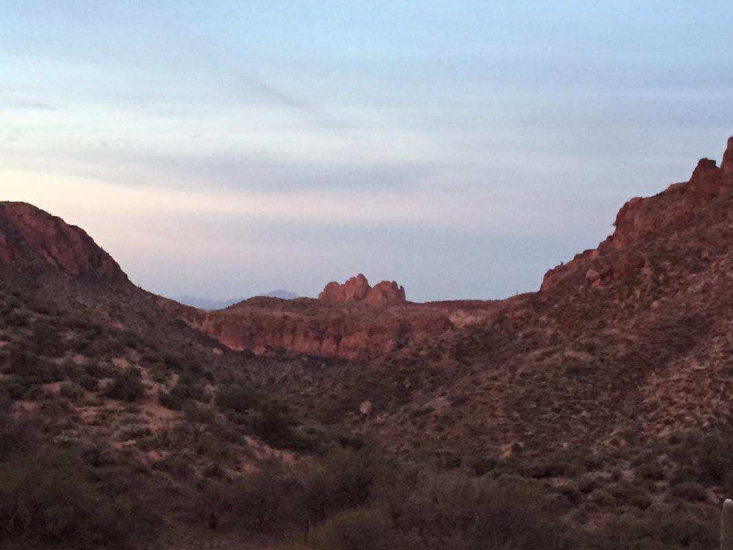
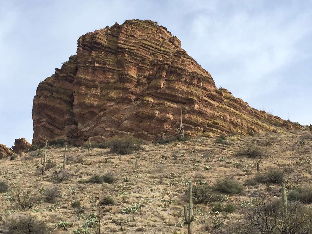
Hiking south from Picketpost, the trail meandered around the west side of Picketpost Mountain, a spectacular looking sight that dominated the view for miles. It's kind of a strange looking, flat topped mountain, but spectacular nonetheless. It was a quite a sight.
Eight miles into the hike, I came to a life-saver for the hikers on this trail: Forrest Road 4. Rugged, steep, and uneven, FR 4 is impassible unless you have a high-clearance 4WD or an ATV. But just off FR 4, where it meets the Arizona Trail, is a resupply box. Kind trail angels come out in their high clearance trucks and ATVs and restock the box with gallons and gallons of water. A couple people even left their cell numbers, encouraging hikers to text if they were in trouble and needed an emergency ride into town. Forrest Road 4 was the perfect place to stop, eat something, and top off my water bottles.
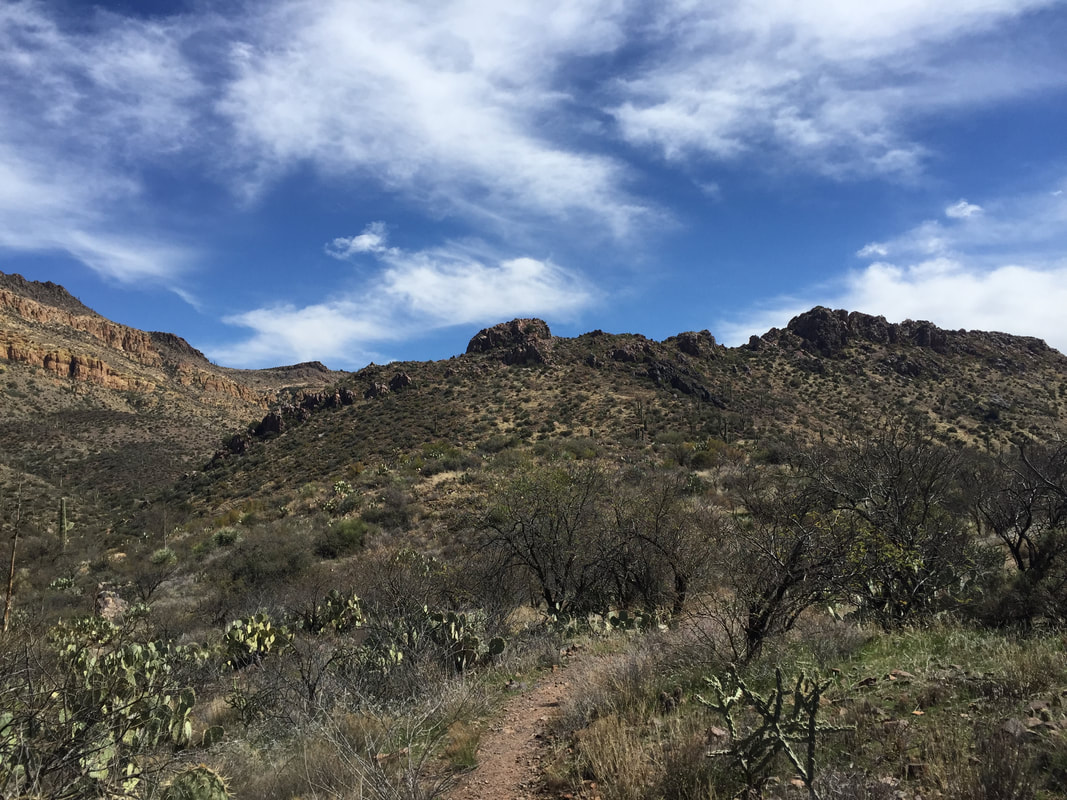
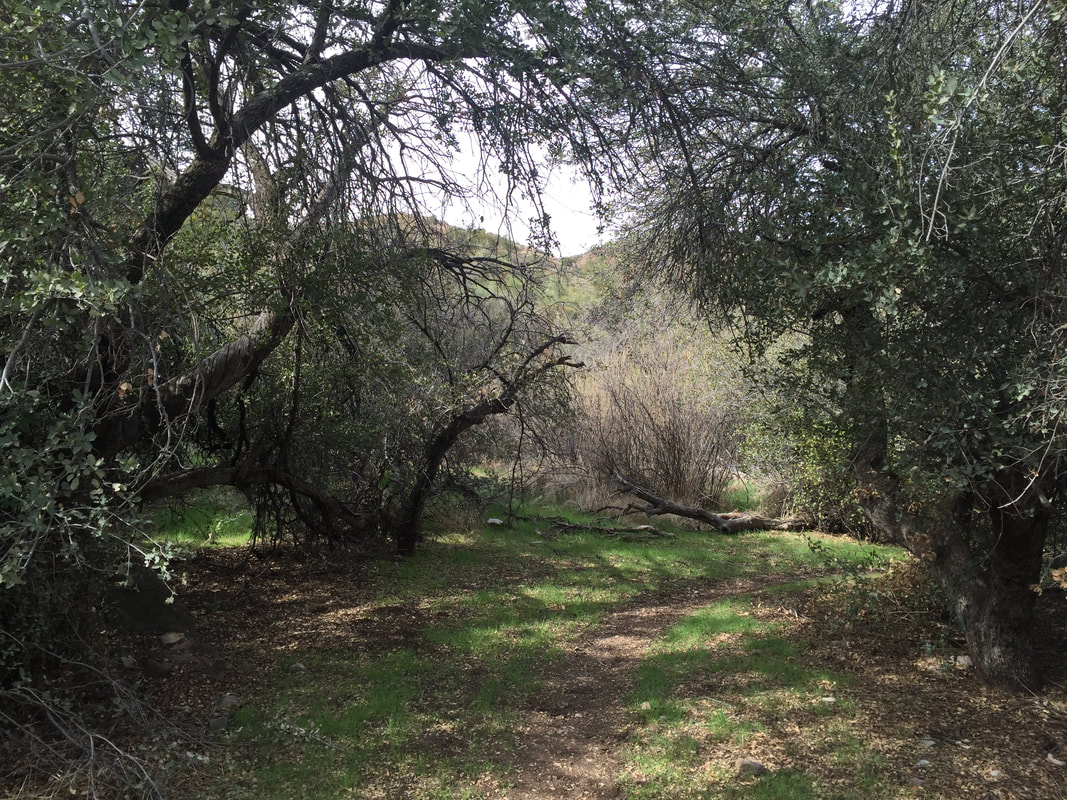
After FR4, the trail climbed a bit more, crested a ridge, and then dropped down into a valley. It was easy to see how this valley would look in higher-snow-years. There was a still-green grassy patch with trees and a dry river bed. In higher precipitation years, this would be an oasis! Not so this year. But it was still quite pretty.
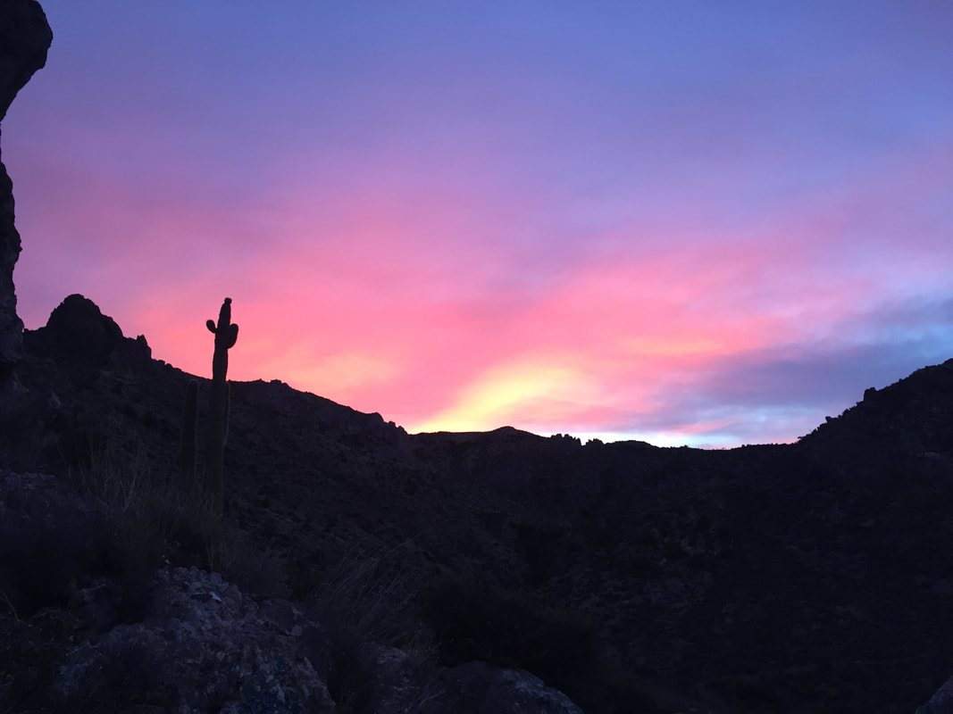
After a steep climb out of the valley, the trail wound around a ridge and then joined a dirt road that lead up to a gate. This was the gate the trailhead hosts had been talking about. I scouted around for a while and decided that the best camping spot was about .1 miles past the gate, up a hill, on the top of a small crest. The dirt road had clearly not been used in several years- it was in a state of complete disrepair- but was also clearly popular with equestrians. ( I had to choose my tent site carefully, away from horse bombs!) Later, I would realize how great this tent site was, when the sun set and the stars came out.
After a steep climb out of the valley, the trail wound around a ridge and then joined a dirt road that lead up to a gate. This was the gate the trailhead hosts had been talking about. I scouted around for a while and decided that the best camping spot was about .1 miles past the gate, up a hill, on the top of a small crest. The dirt road had clearly not been used in several years- it was in a state of complete disrepair- but was also clearly popular with equestrians. ( I had to choose my tent site carefully, away from horse bombs!) Later, I would realize how great this tent site was, when the sun set and the stars came out.
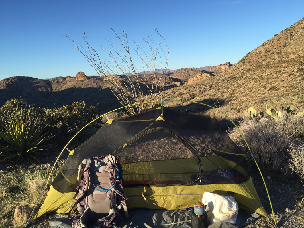
It was unusual, but kind of nice to have camp set up while the sun was still in the sky. Usually, I hike until sunset, and its a mad scramble to set up camp, change, and make dinner before darkness falls. Today was both leisurely and quite decadent!
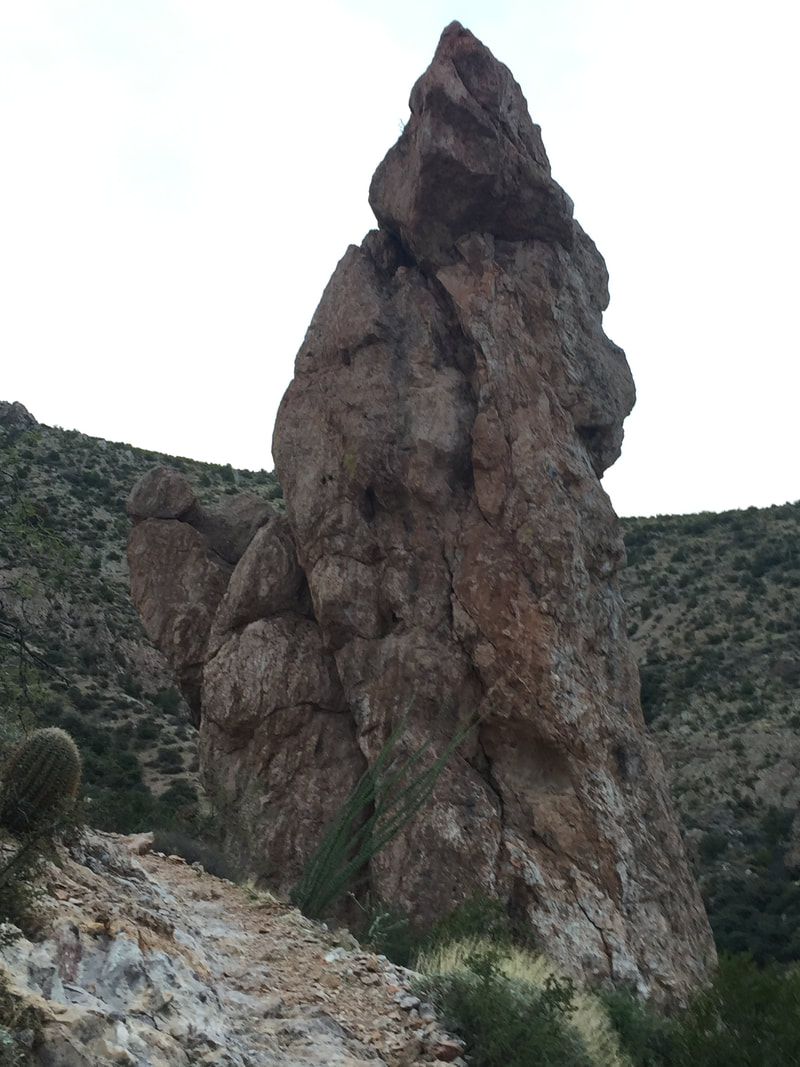
In the morning, I got dressed, grabbed a small day-bag with water and some snacks, and left the rest of camp as is. Then I backtracked toward the ridgeline and canyon that was back another 3 miles. The views did not disappoint! There were cool spire-like rock formations, steep drop offs with views below, and a little green patch I dubbed "the fairy ring" in my head. Like the valley from yesterday, there was still some green left and it was easy to see how it would look in higher snow years.
After my 7 mile out and back, I arrived back to break down camp, load up the big pack, and start back toward Picketpost. While it had been cool and pleasant around sunrise, the temperature was quickly rising and I tried to go as quickly as I could.
I once again stopped at FR4 for a little rest and water. This time, I only took about a half liter of water. Generally, when looking at reliable water sources, I strive to have about a half liter left when I hit the next source. Especially when dealing with caches. I try not to hog the water at water caches, knowing that a lot of people will becoming after me and will be relying on that water.
Today, rather than having a half liter left when I reached Picketpost, I instead ran out of water a half mile away. Still, I'm chalking that one up to perfect planning. I can easily walk a half mile without water. Running out 6 miles away, however, may have posed a problem.
Once back at the trailhead, I took advantage of the abundant water, restroom facilities, and snack offerings from the camp hosts. Heading back toward Superior, I offered rides to a couple of scraggly looking hikers, but it turns out they were just really scruffy day hikers, not thru-hikers!
After this great section, I ate some wonderful Mexican food in Superior, and then headed back to put the jeep back in storage. It was time to get back into thru-hiker mode and hit the Superstition Mountains like a champ!
After this great section, I ate some wonderful Mexican food in Superior, and then headed back to put the jeep back in storage. It was time to get back into thru-hiker mode and hit the Superstition Mountains like a champ!
 RSS Feed
